June 15th, 2025 - Mývatn
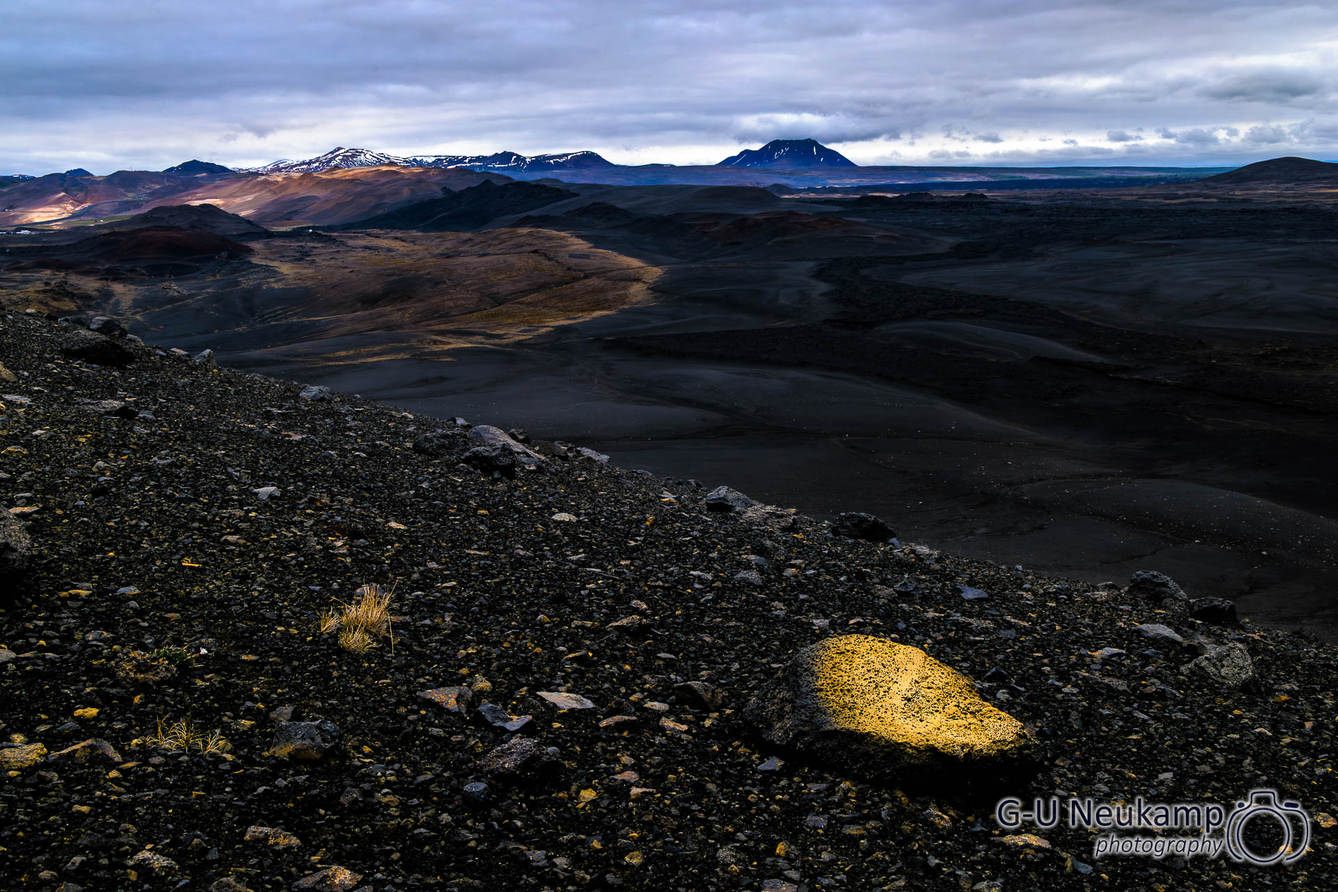
After yesterday’s long and exhausting day, we slept in. Today, we started by exploring the immediate surroundings of Lake Mývatn. Incidentally, Mývatn means “mosquito water.” Currently, the nuisance caused by the bloodsuckers was minimal, probably due to the relatively strong wind, so we didn’t need to use the mosquito nets we had brought with us. Unfortunately, the weather was not kind to us; it was cold, the sky was overcast, and there was occasional light rain.
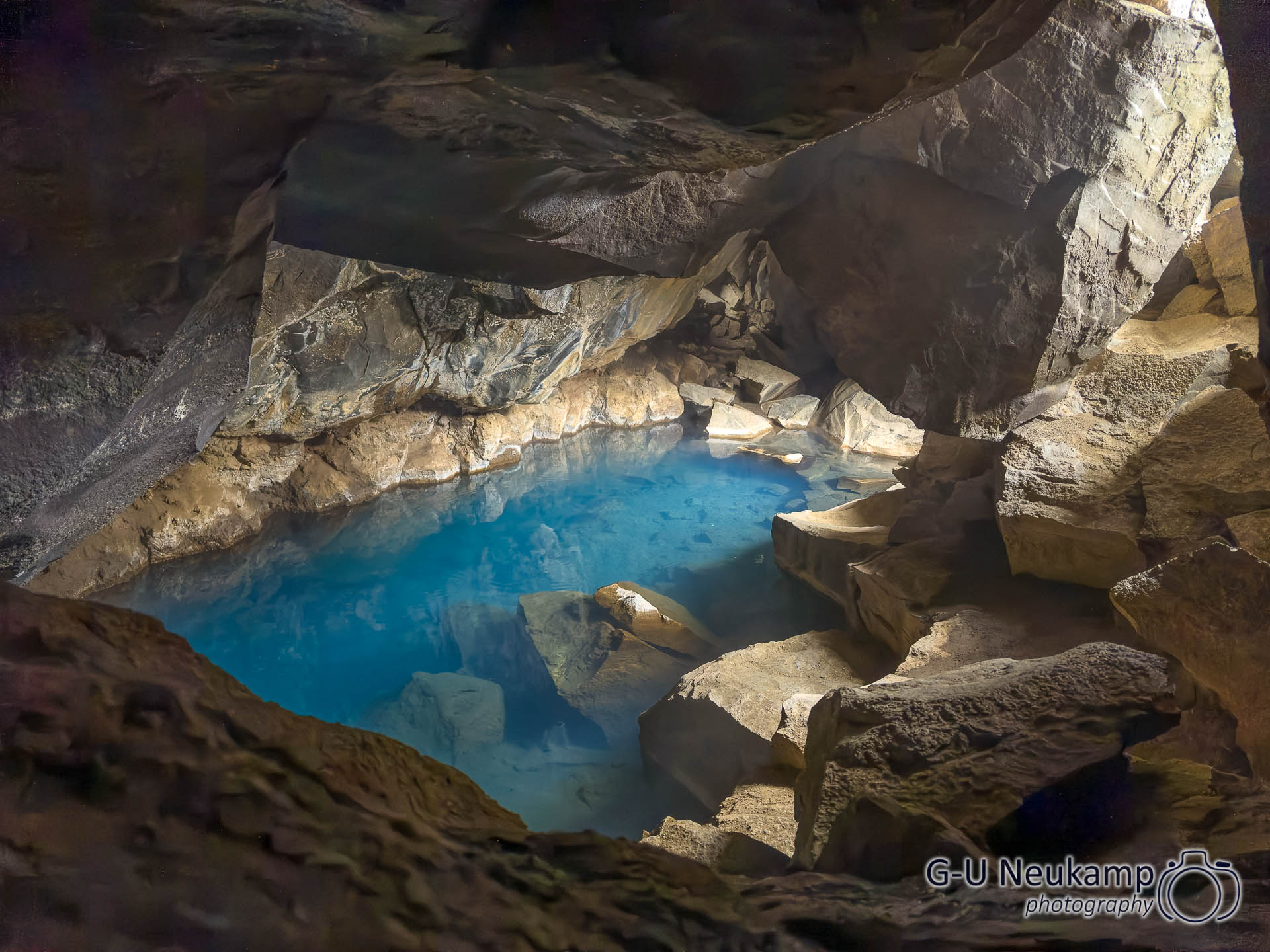
Our first destination was a lava cave in the immediate vicinity of the campsite, Grjótagjá.
Grjótagjá is a rock cave with a small, geothermally heated lake located directly on the visible fault line between the American and European continental plates. As early as the 18th century, the outlaw Jón Markússon is said to have used the cave as a hideout and bathing spot. It was later rediscovered by English students in 1938 and developed into a popular bathing resort until the 1970s. However, increased geothermal activity caused by the so-called Krafla fires heated the water so much that it temporarily reached over 60 °C – far too hot for bathing! Today, the cave is privately owned and swimming is officially prohibited.
Grjótagjá became famous as the location for the love scene between Jon Snow and Ygritte in the third season of Game of Thrones.
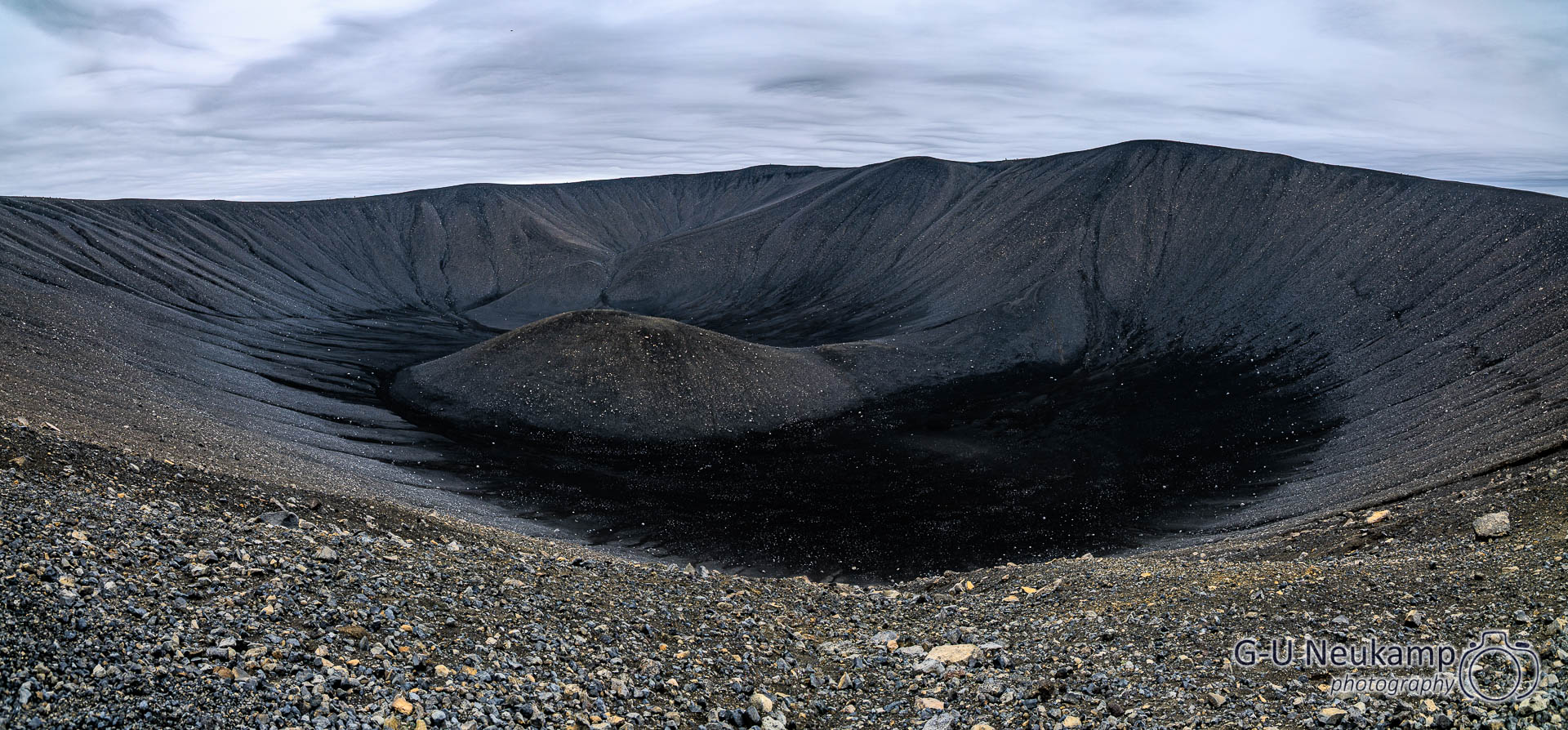
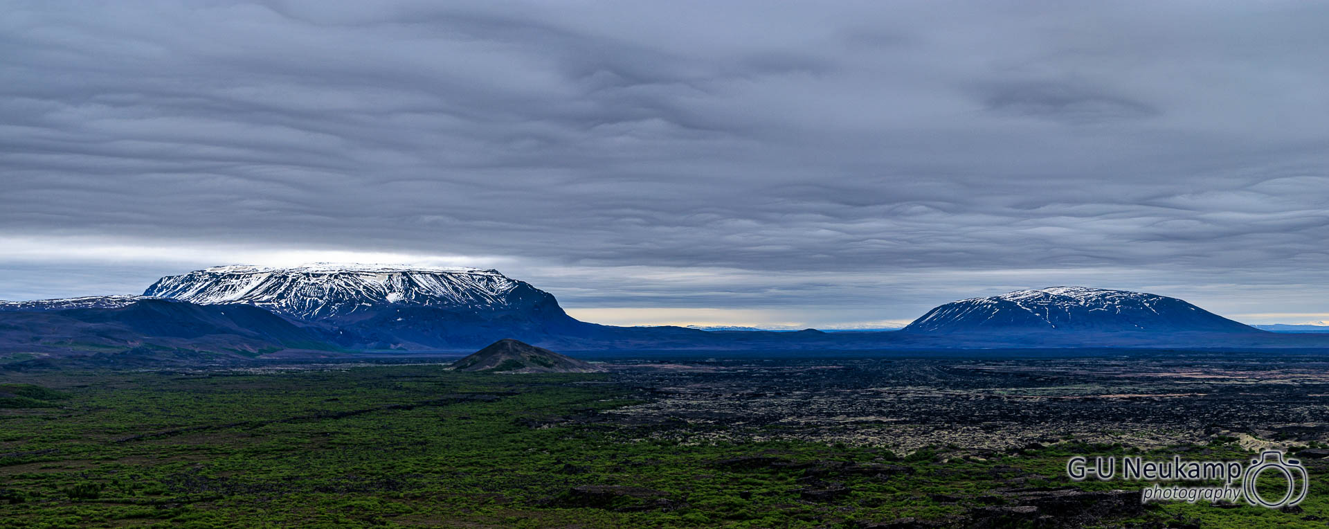
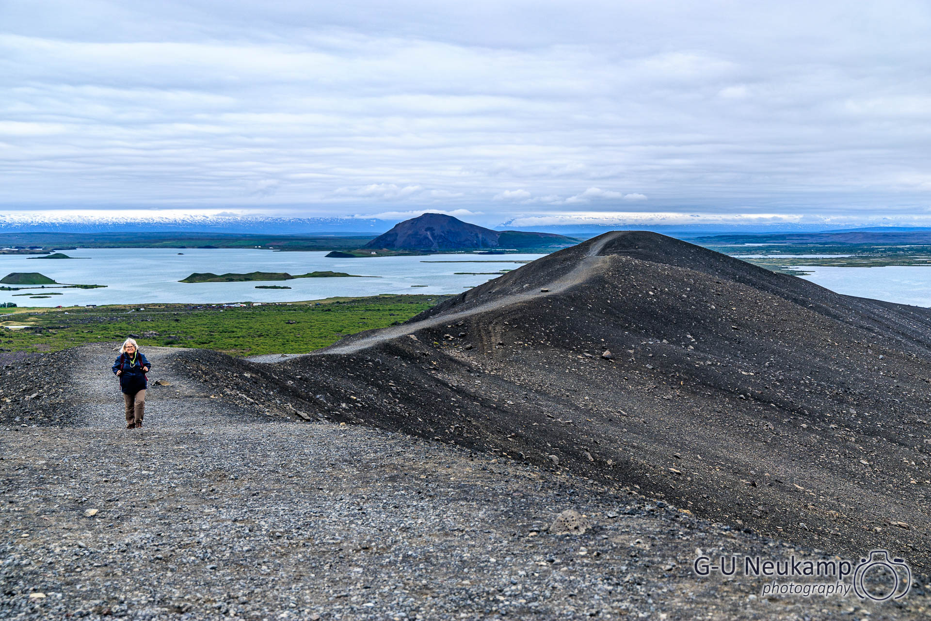
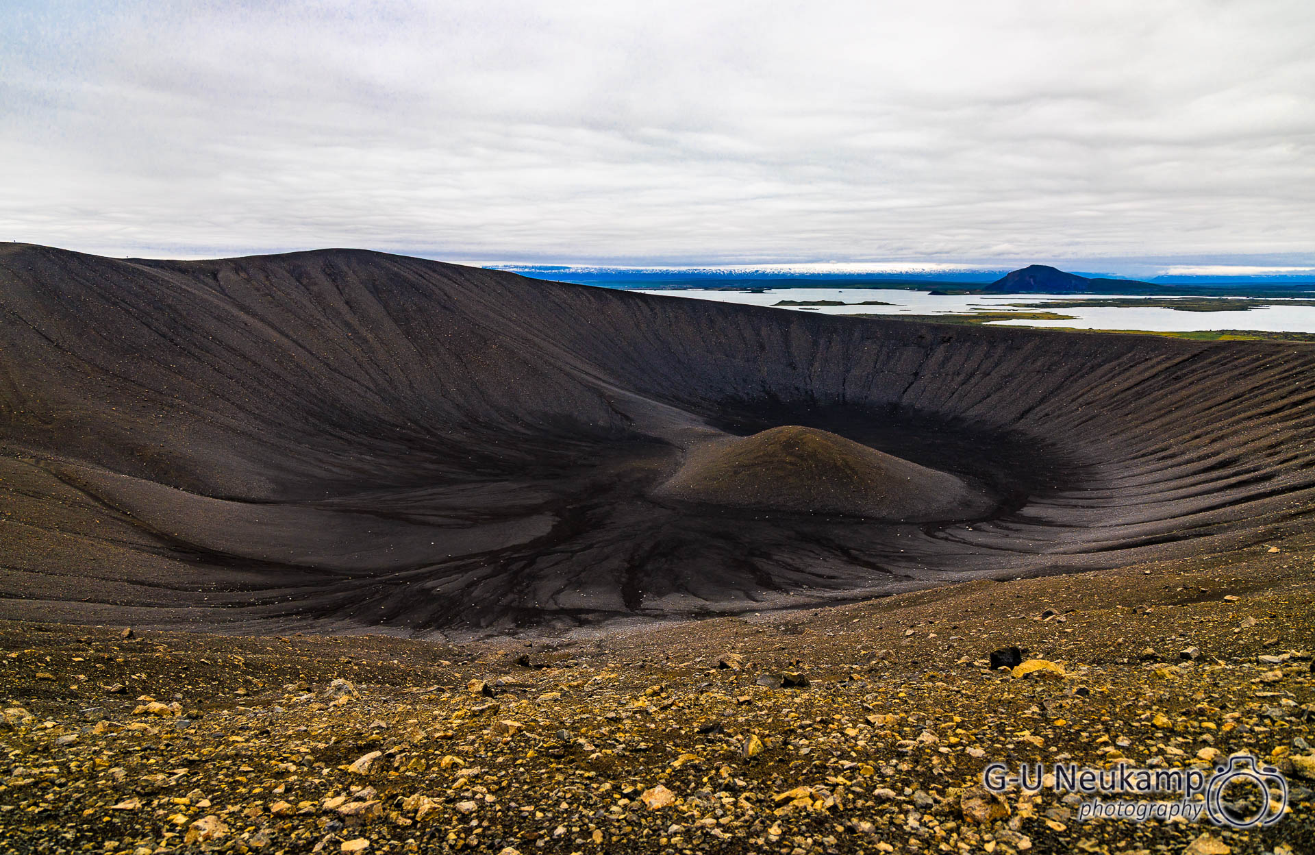
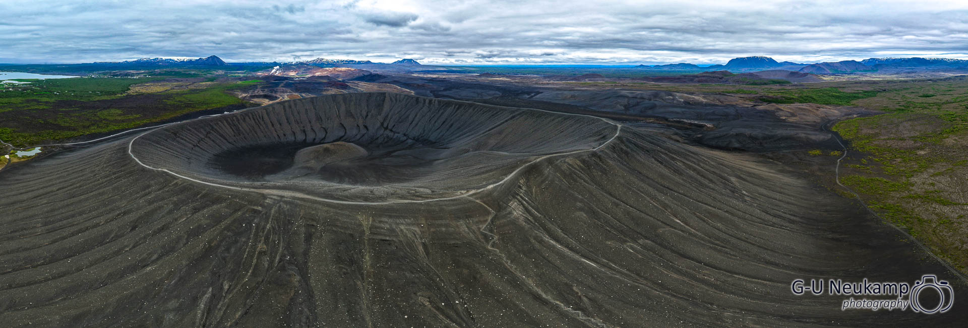
We then drove to the Hverfjell crater, only about 3 kilometers away. It was formed about 2,800 years ago, is about 200 meters high, and has a diameter of 1,000 meters. The climb was a bit steep, but manageable. Once at the top, you can walk around the crater rim. The walk is about 4 kilometers long. From the top, there was a great view of the black crater and the surrounding area. In the distance, we could see the steaming hot springs of the Namafjall Hverir geothermal area again.
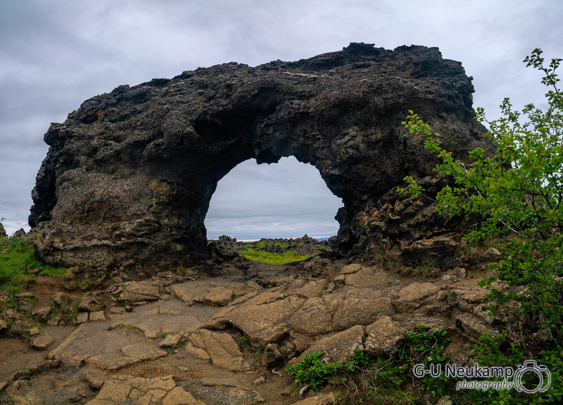
We then continued on to the Dimmuborgir lava field. There, surrounded by low vegetation such as dwarf pines, you can admire solidified lava columns. The bizarrely shaped rock formations of the lava field are reminiscent of the ruins of castles and towers. In Icelandic mythology, Dimmuborgir is seen as the home of elves and trolls.
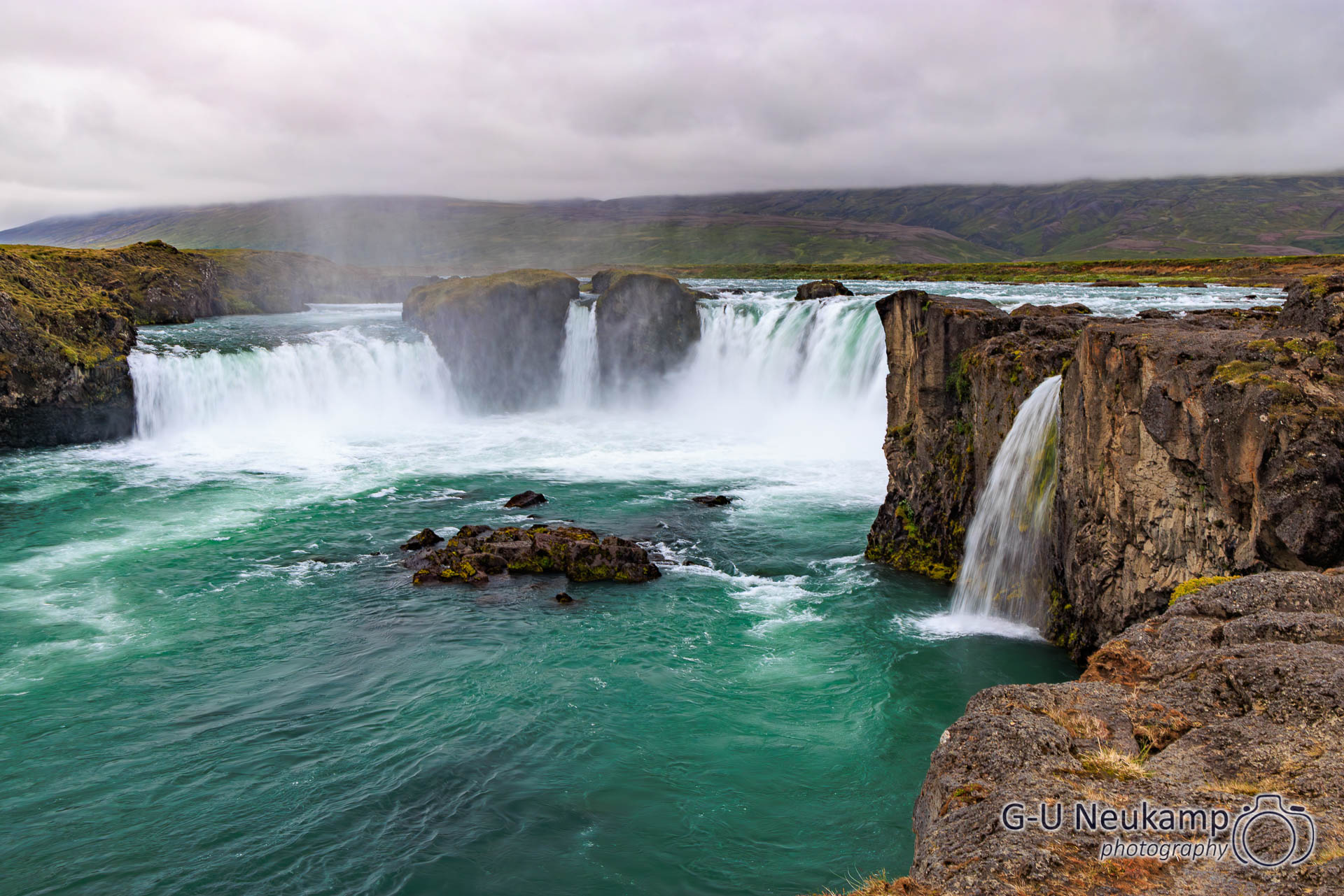
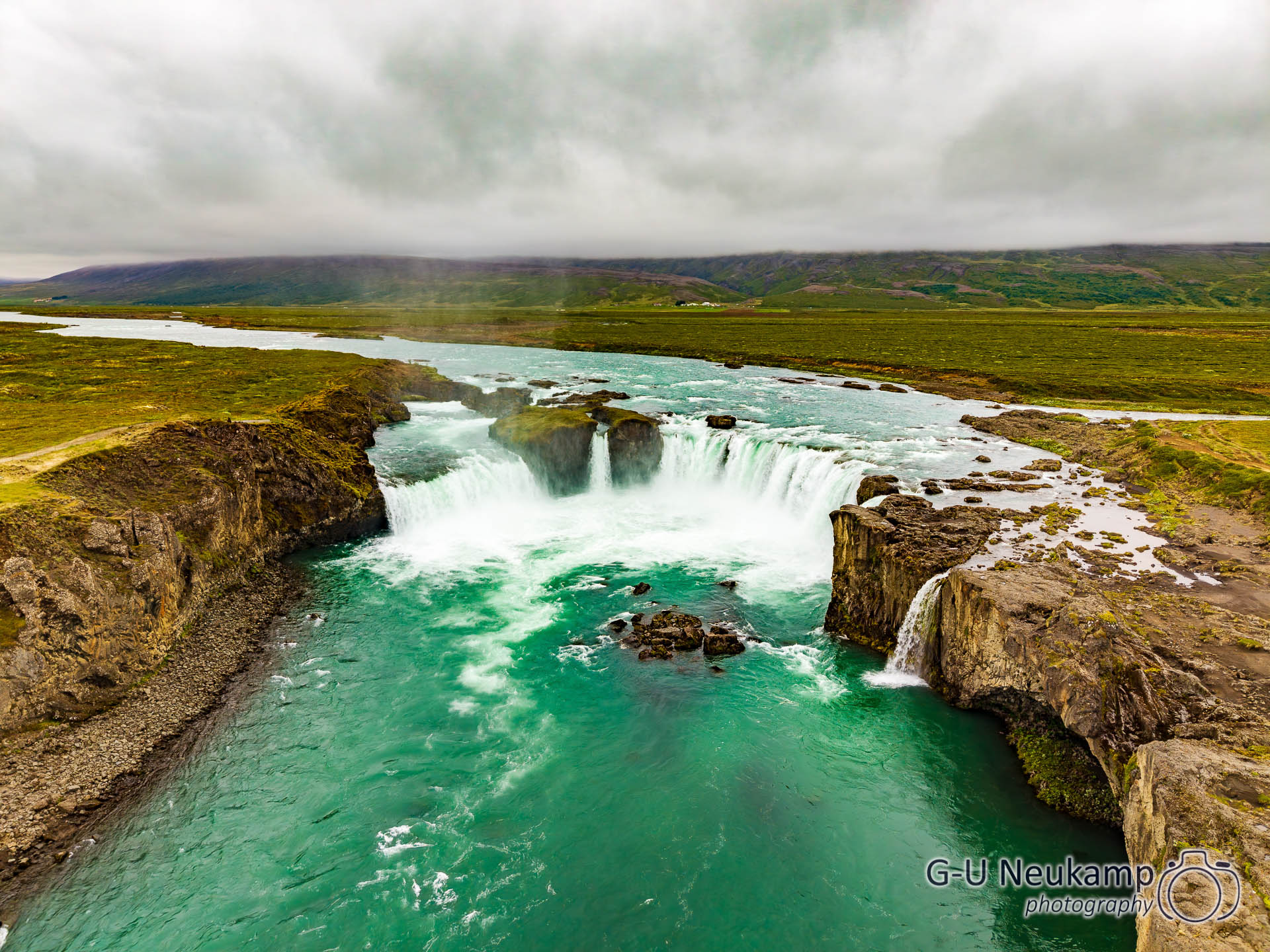
Afterwards, we proceeded to Goðafoss. It is located in the northeast of Iceland within sight of the ring road, and we could already see it from a distance. It is one of Iceland’s most famous waterfalls. The water of the Skjálfandafljót plunges 11 meters in a wide arc from a width of 158 meters, interrupted by three rocks.
The name Goðafoss (“Waterfall of the Gods”) dates back to a tradition from around the year 1000. At that time, the Icelandic parliament (Alþingi) decided to adopt Christianity as the state religion. The god and law speaker Þorgeir Ljósvetningagoði Þorkelsson is said to have thrown the pagan idols into the waterfall. A stained glass window in Akureyri Church commemorates this event.
After that, we drove on to Akureyri, our final destination for the day.
With just under 20,000 inhabitants, Akureyri is Iceland’s fourth largest city after Reykjavík and its suburbs Kópavogur and Hafnarfjörður. The port city is considered the most important center in the north of the country, both for services and as a regional population center. Since 2009, the small island of Grímsey, through which the Arctic Circle runs, has also belonged to the municipality of Akureyri.
We spent the night here at the local campground (large, idyllically located, even with playgrounds and a small lake where you can ride pedal boats). Before that, we went shopping in town again and took a look at where the boat safari would start tomorrow. We had booked a whale watching tour online. It starts at 8:30 a.m. tomorrow morning, so we went to bed a little earlier today.