June 10th, 2025 - Vik and Puffins
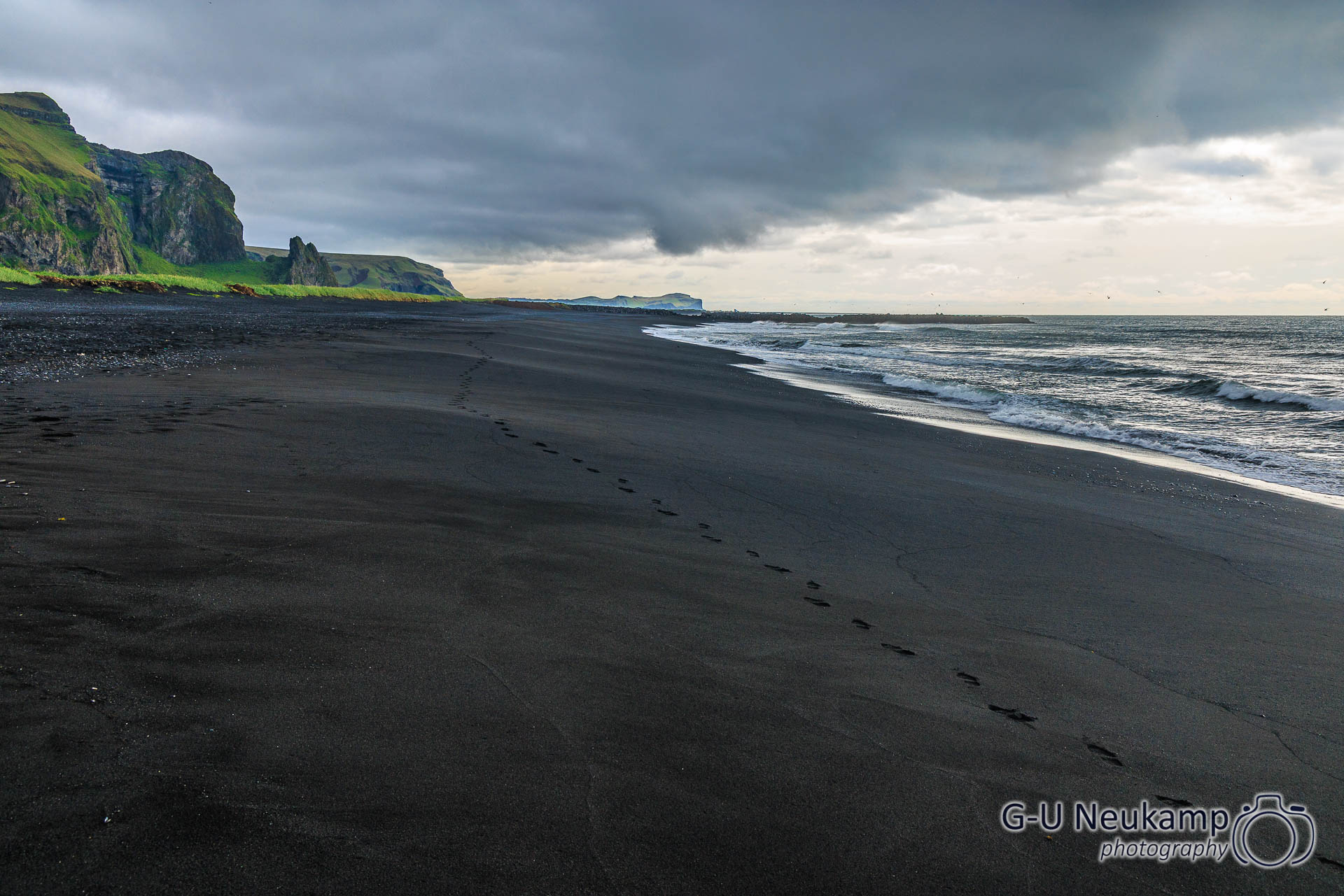
It was a very rainy night, it had been pouring with rain, but it was soooooooo cozy in the camper. After breakfast and the usual camper routine (emptying the toilet cassette, filling up the water tank), we first drove to a shopping center above the beach in Vik to stock up our supplies. However, the grocery store was closed because of a power outage. So we used the time until it was fixed to go down to the beach.
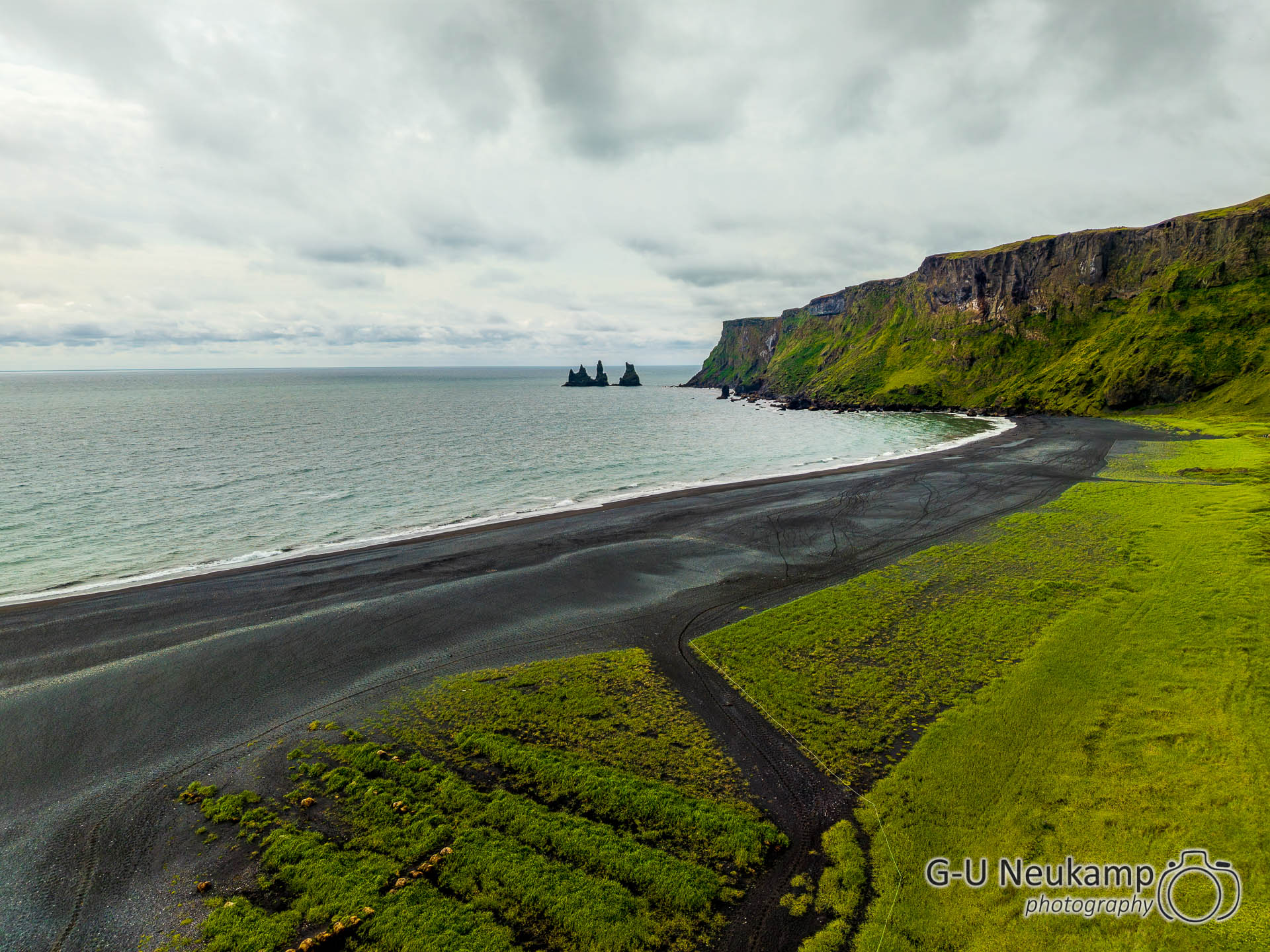
Vík í Mýrdal, meaning “bay by the swampy valley,” is located in the Icelandic municipality of Mýrdalur and is the southernmost town on the Icelandic mainland. On January 1st, 2023, the town had 645 inhabitants; it is an important service and supply center for the people around Mýrdalsjökull. The town is home to the famous Reynisfjara beach, which is formed from black lava: in 1991, it was voted one of the ten most beautiful beaches in the world by Islands Magazine.
There are three black rock pillars (dykes) made of solidified basalt lava in front of the coast: the Reynisdrangar (“young men’s trials”), Skessudrangu, Landdrangur, and Langsamur. There is a legend that trolls wanted to bring a ship ashore and were turned to stone in the process.
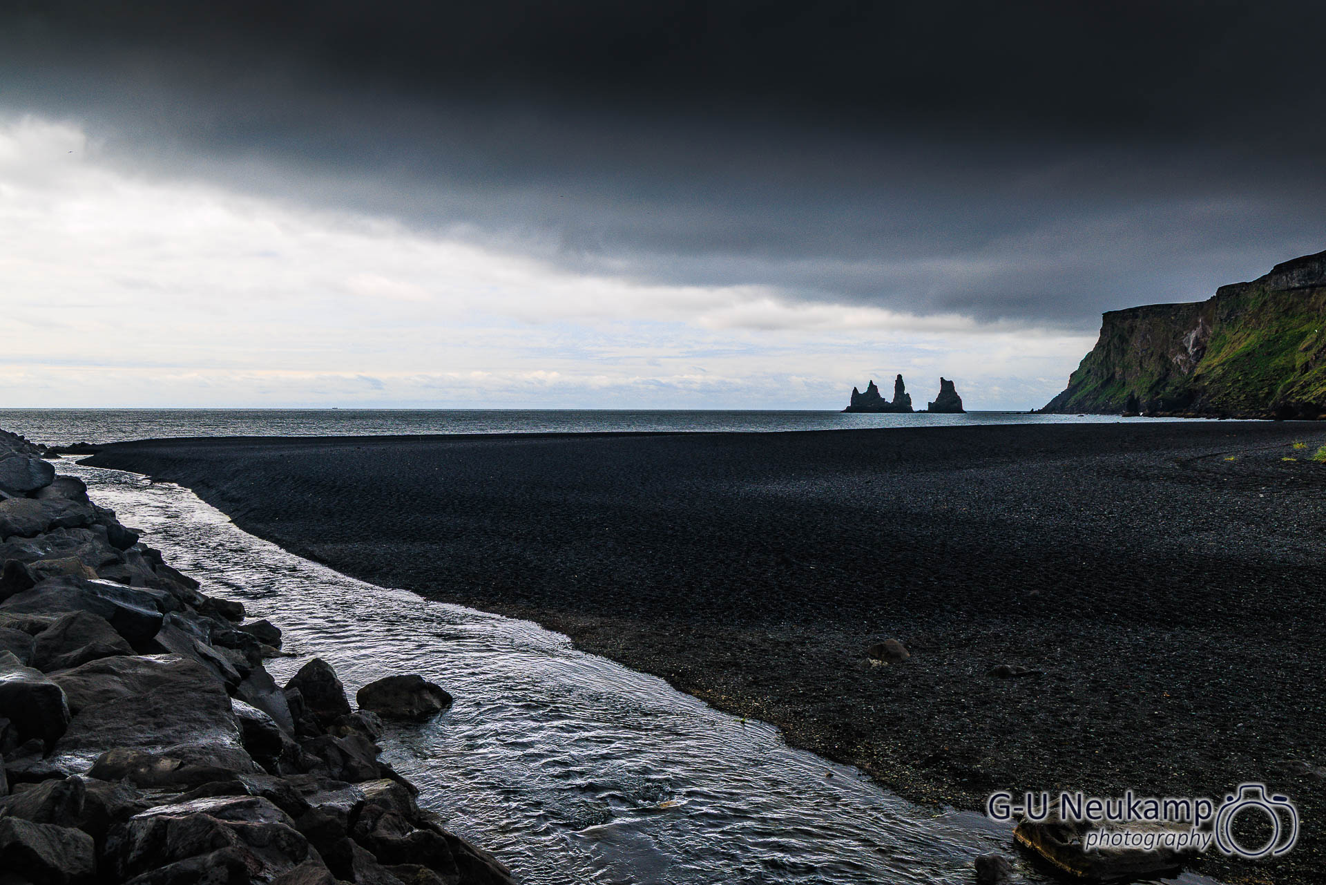
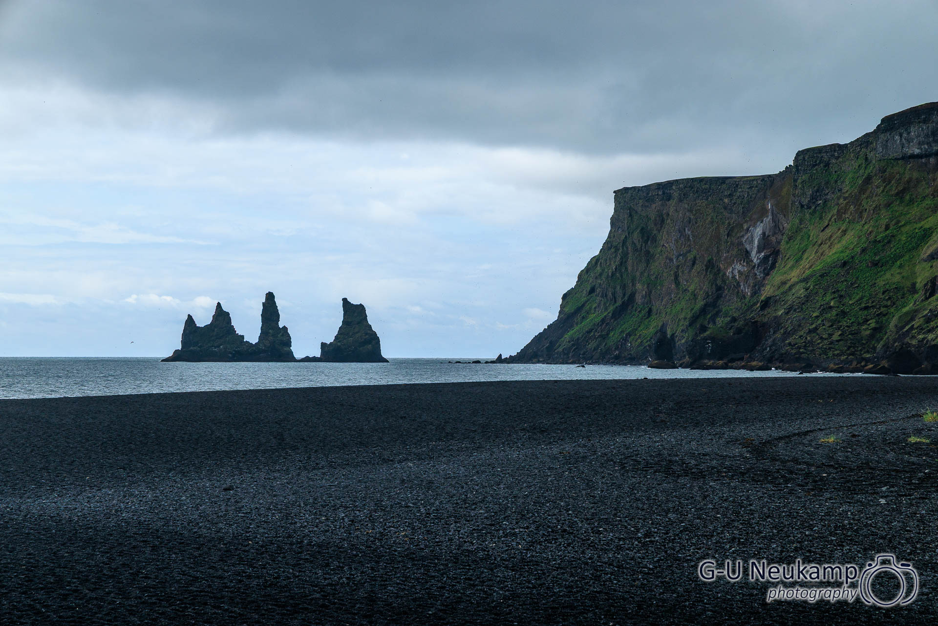
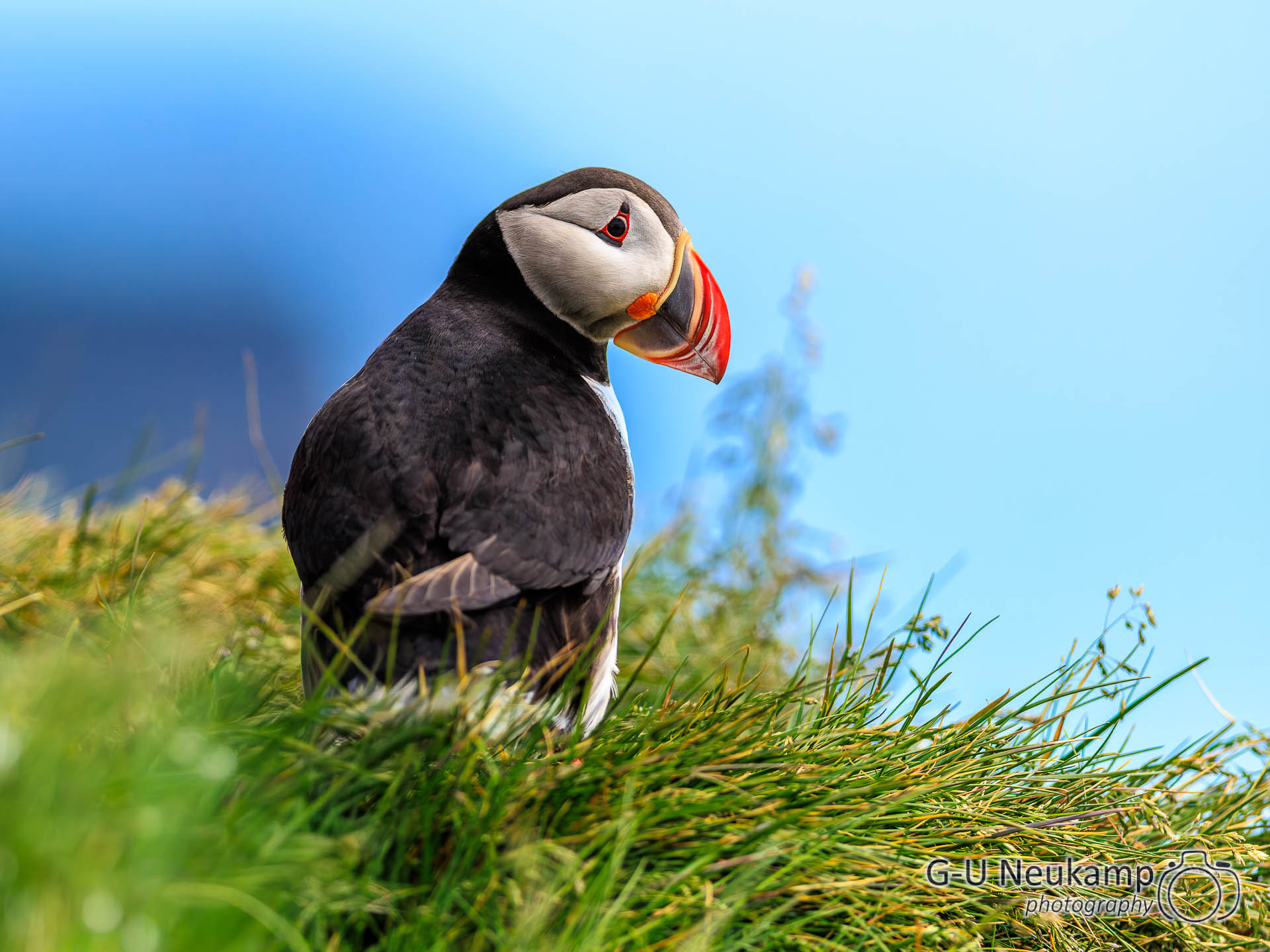
We then walked a little further along the beach to the headland on the right, where we spotted our first puffins. They rank pretty high on the cuteness scale:

After returning, the shopping center was back on power and we stocked up our food supplies. Our next destination was now the Dyrhólaey peninsula.
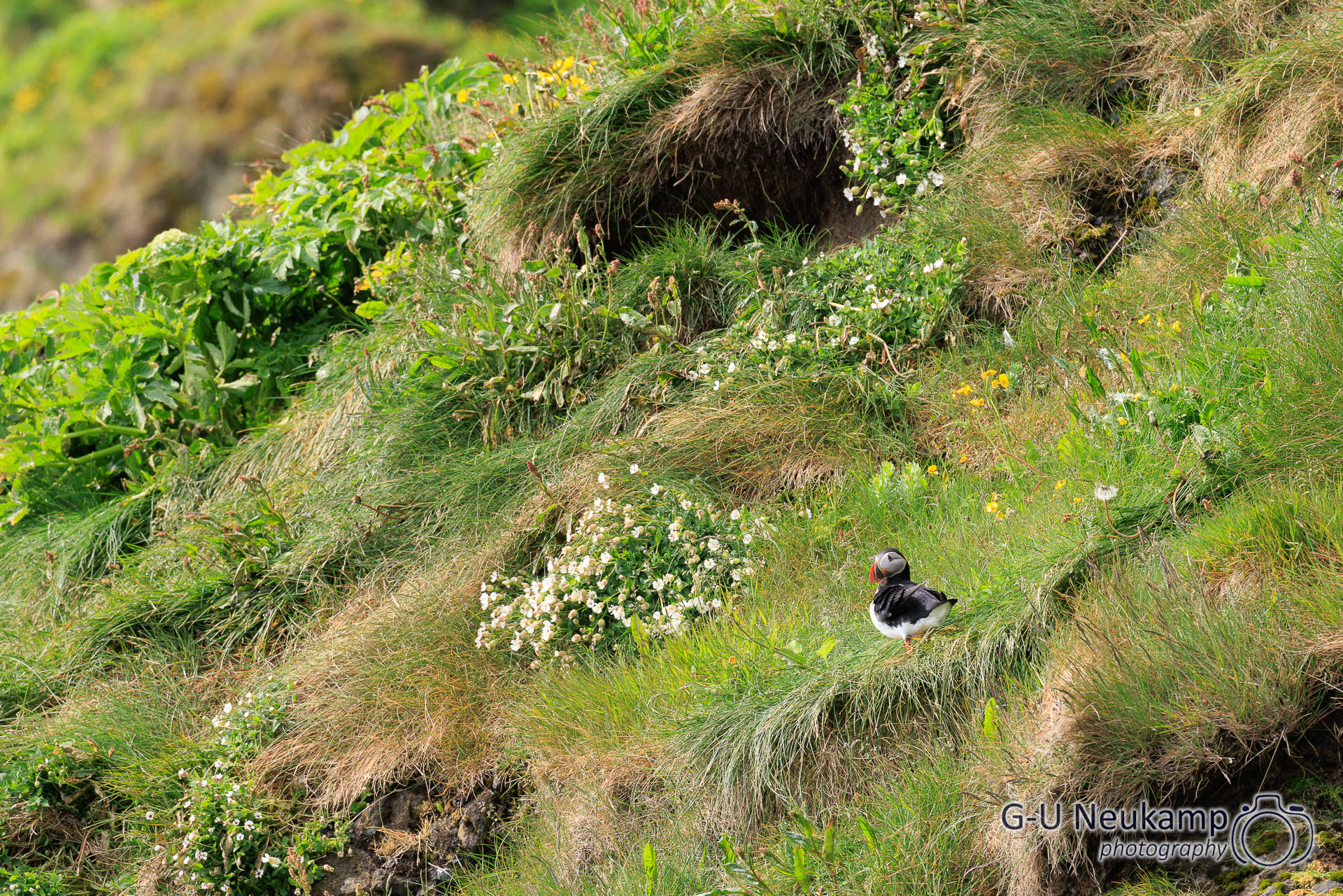
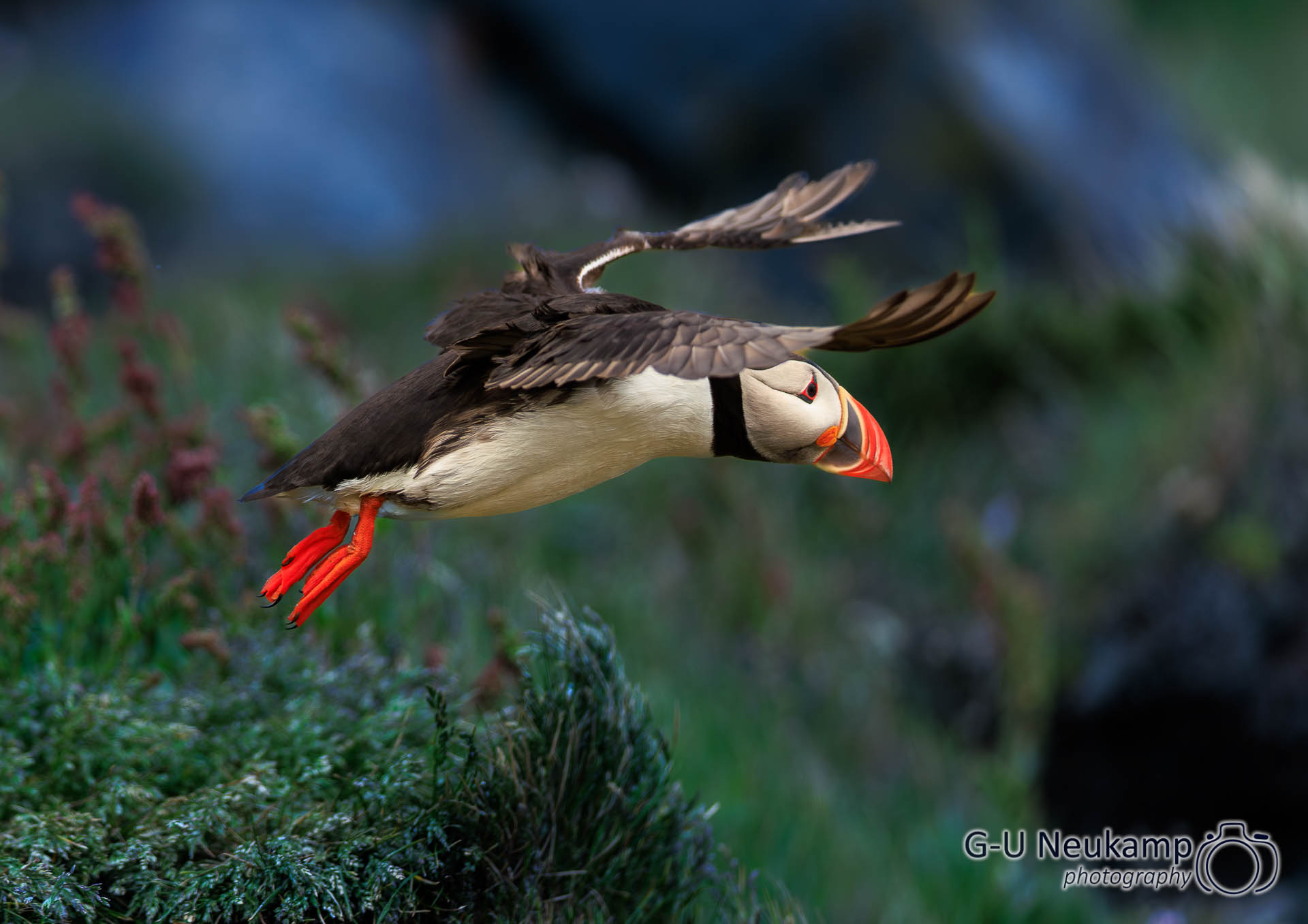
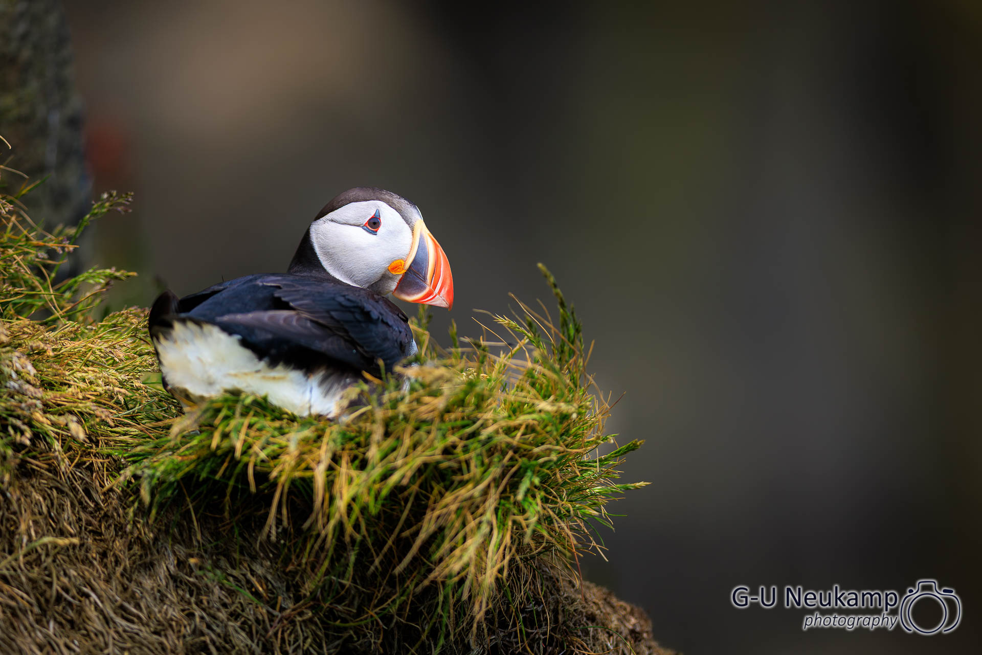
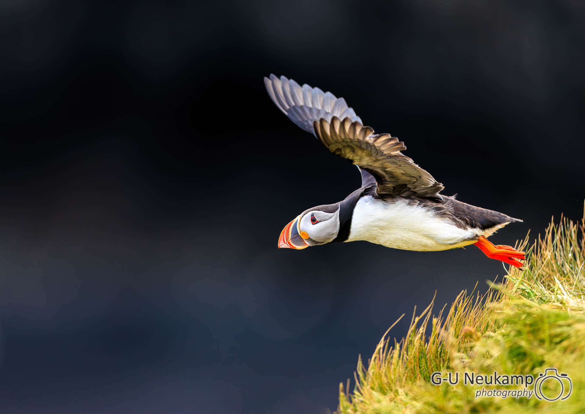
Dyrhólaey (Icelandic for “doorhole island”) is a 115-meter-high peninsula in southern Iceland, about 6 km west of Vík. The cape, which drops steeply into the sea, was formed as an island 80,000–100,000 years ago during a submarine volcanic eruption. The tip of the cape forms a rock arch through which boats can pass, giving the island its name. Dyrhólaey is known for its abundance of birds. In summer, a large colony of puffins nests here alongside terns and other species.
And we were lucky: after a short climb, we got very close to a large colony of nesting puffins. The cute birds were busy delivering more and more food to their offspring waiting in caves. The birds were not shy at all, so we could get very close to them. I was very glad that I had brought my “Big Bertha” (Canon EF 400mm f/2.8L IS II USM) with me on the trip, as it allowed me to take some (in my opinion) very nice pictures of the cute puffins:
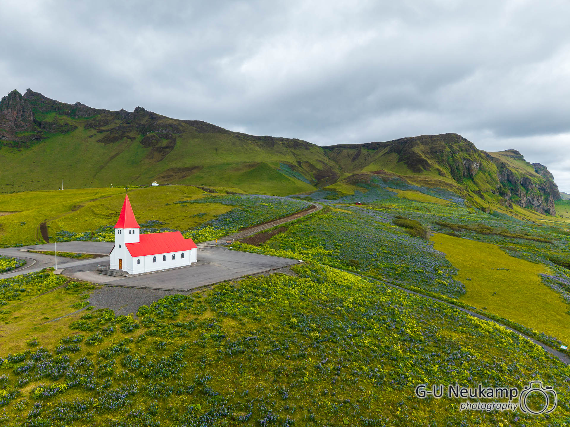
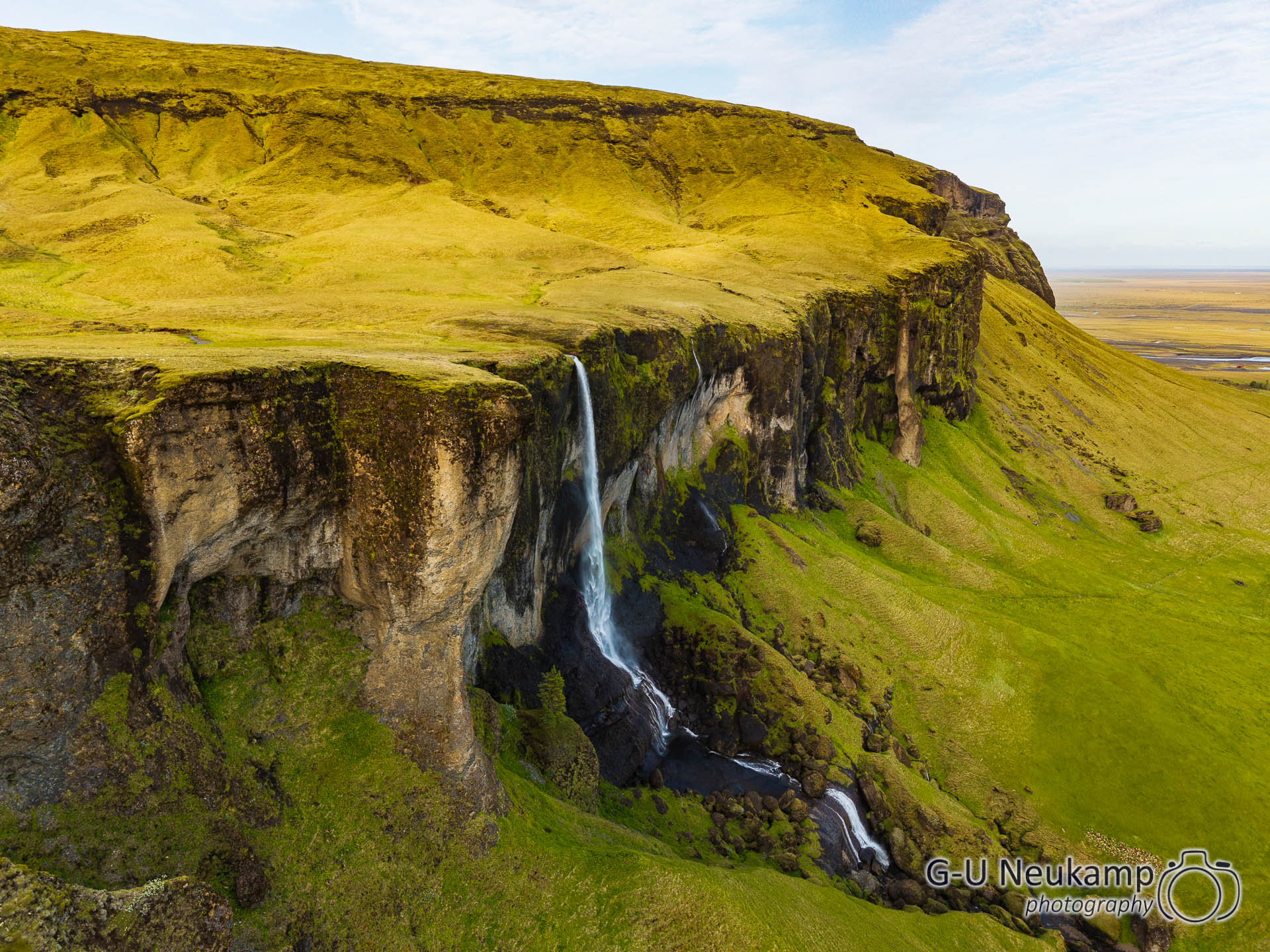
That was absolutely magnificent. We then continued along the ring road through Vik again, where I took some more shots with the drone as the weather had improved:
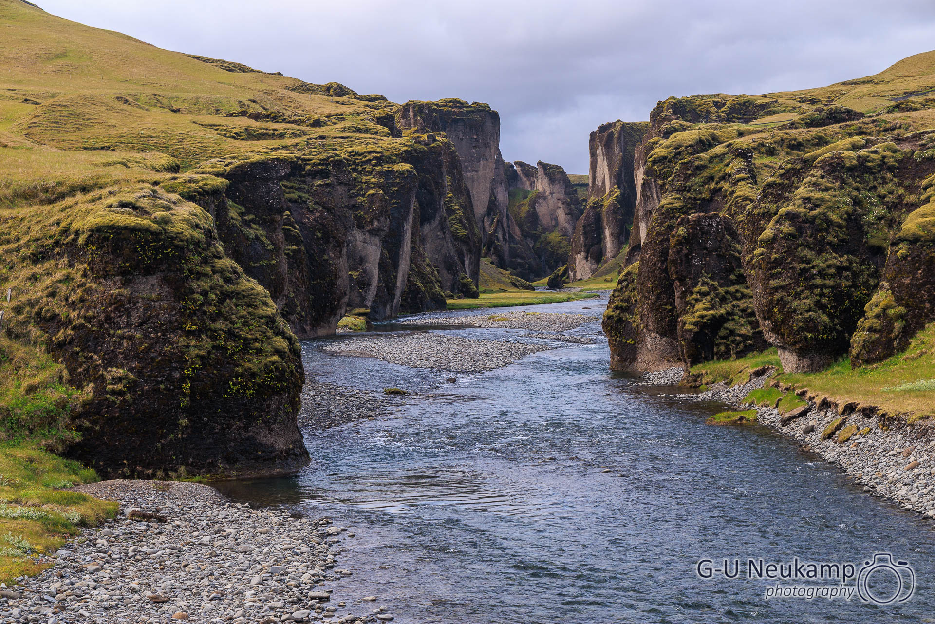
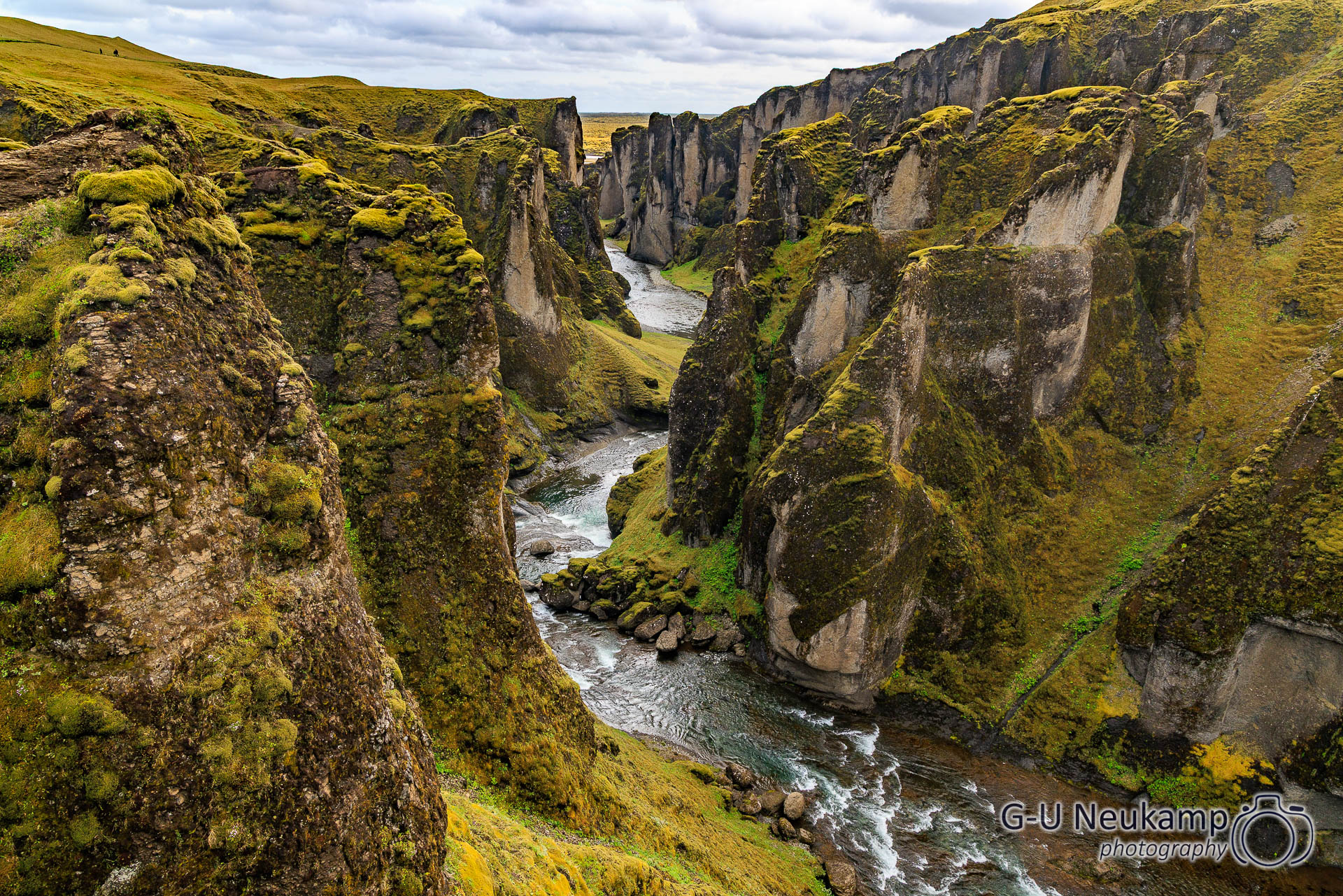
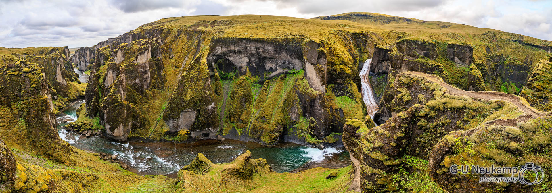
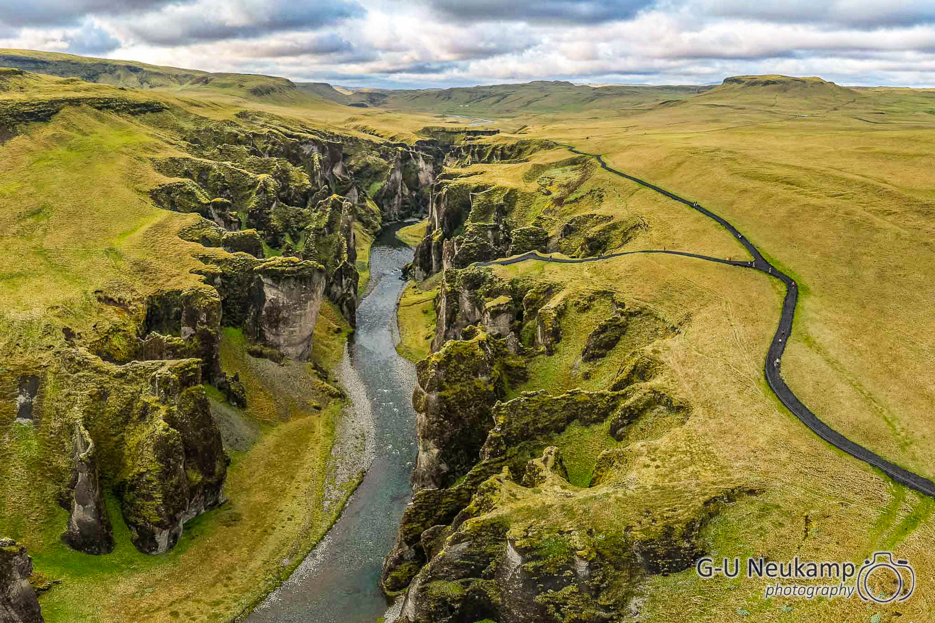
We continued on to Fjaðrárgljúfur Canyon. The gorge is up to 100 meters deep in some places and is about two kilometers long, with the Fjaðrá River flowing through it, giving the canyon its name.
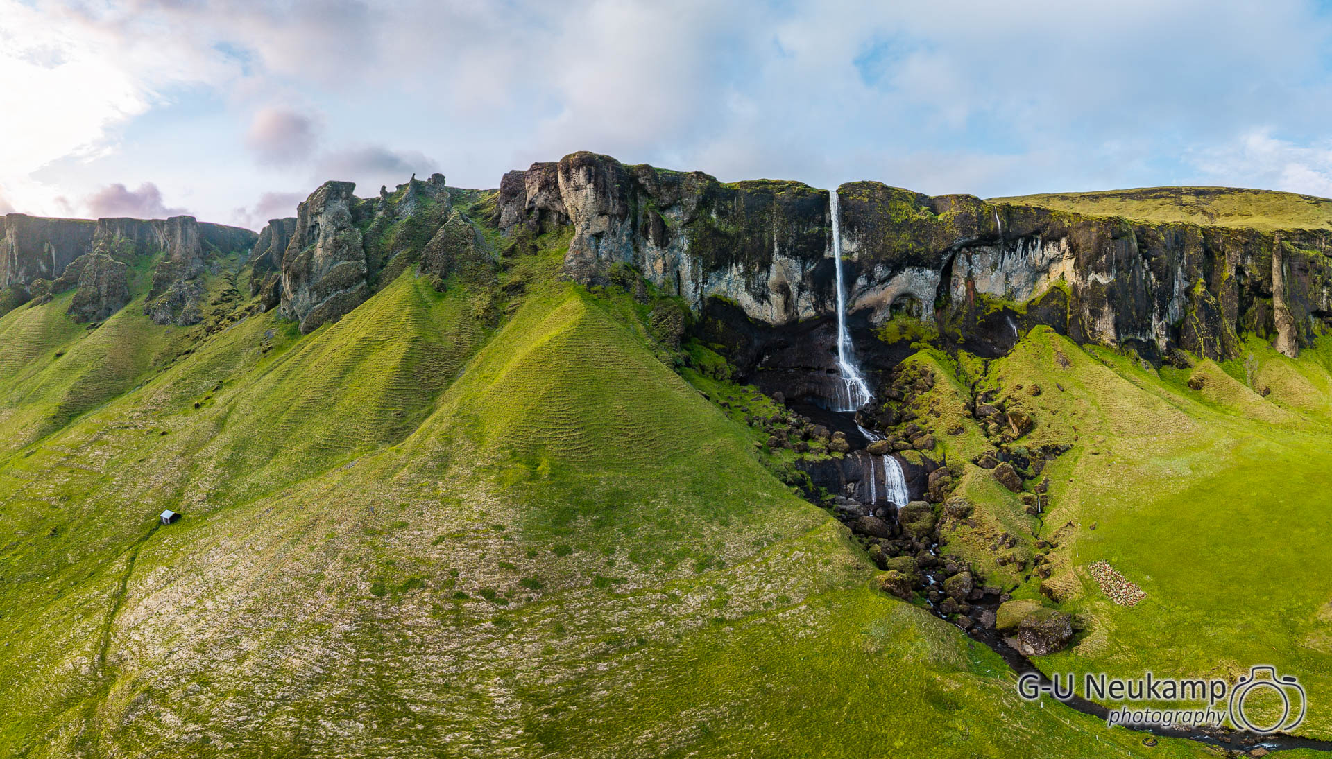
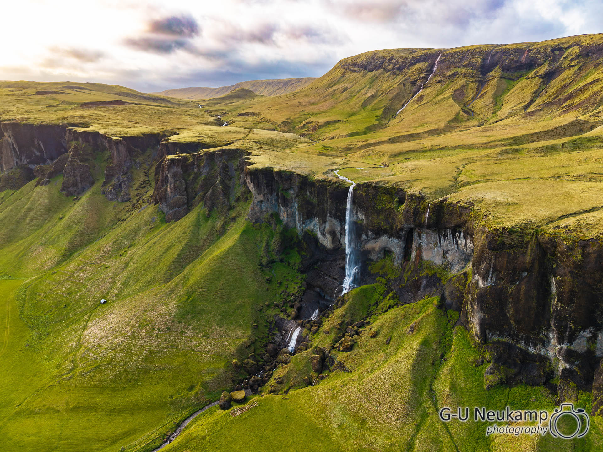
Meanwhile, it had already gotten late. On the way to our overnight location (Skaftafell Camping), we passed a waterfall, the 82-meter-high Foss á Siồu, right next to the ring road. You can’t get right up to the waterfall because the land is a private property. But we were able to take some beautiful pictures with the drone. Best of all, you can operate it from the camper, which means you can sit comfortably in the warm. It’s really great to have a private waterfall like that – now my wife wants one too😉.
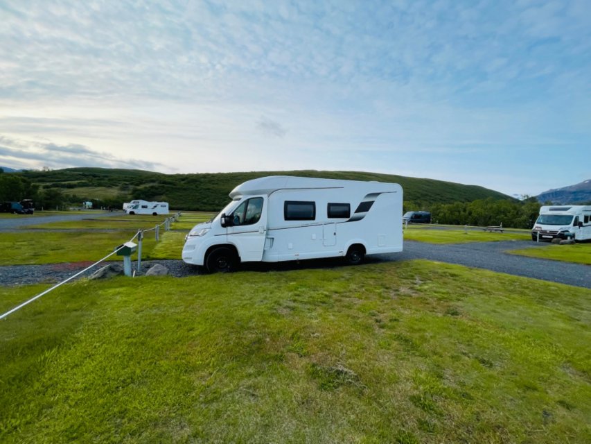
We then continued along the ring road. Finally, we arrived at the foot of the Vatnajökull glacier, where the Skaftafell campground is located. It was large but not very busy. So we found a nice place a little off to the side.
Tomorrow, we plan to hike from here to Svartifoss first. After that, we will continue on toward the ice lagoon.