June 9th, 2025
We slept very well in our camper again, then had a leisurely breakfast and shower. It works great, the shower cubicle is big enough and the shower water is pleasantly warm. The weather was quite good, with lots of blue sky and only a few clouds. But that can change quickly in Iceland. So: let’s go!
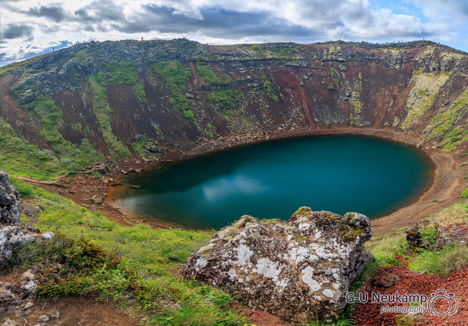
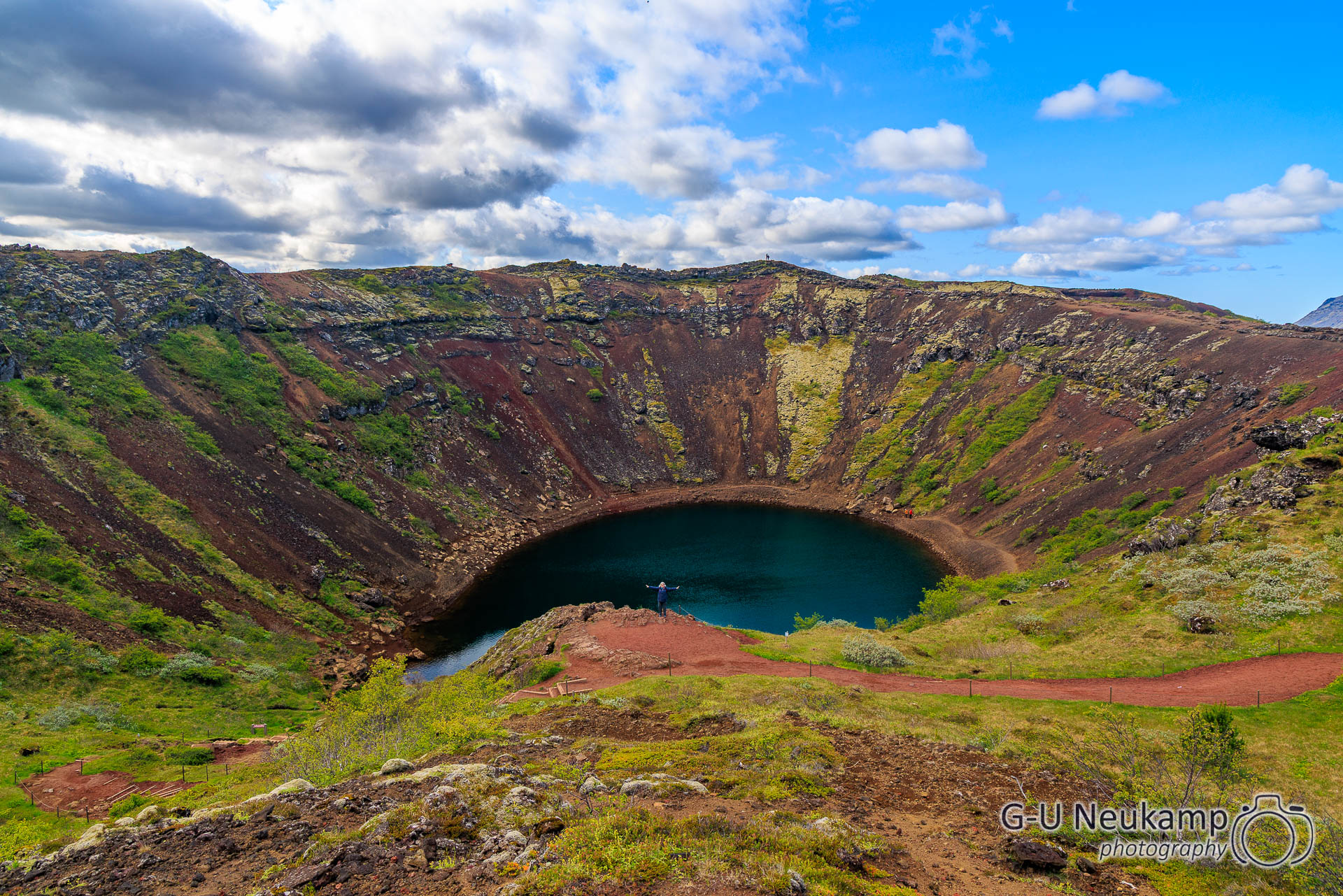
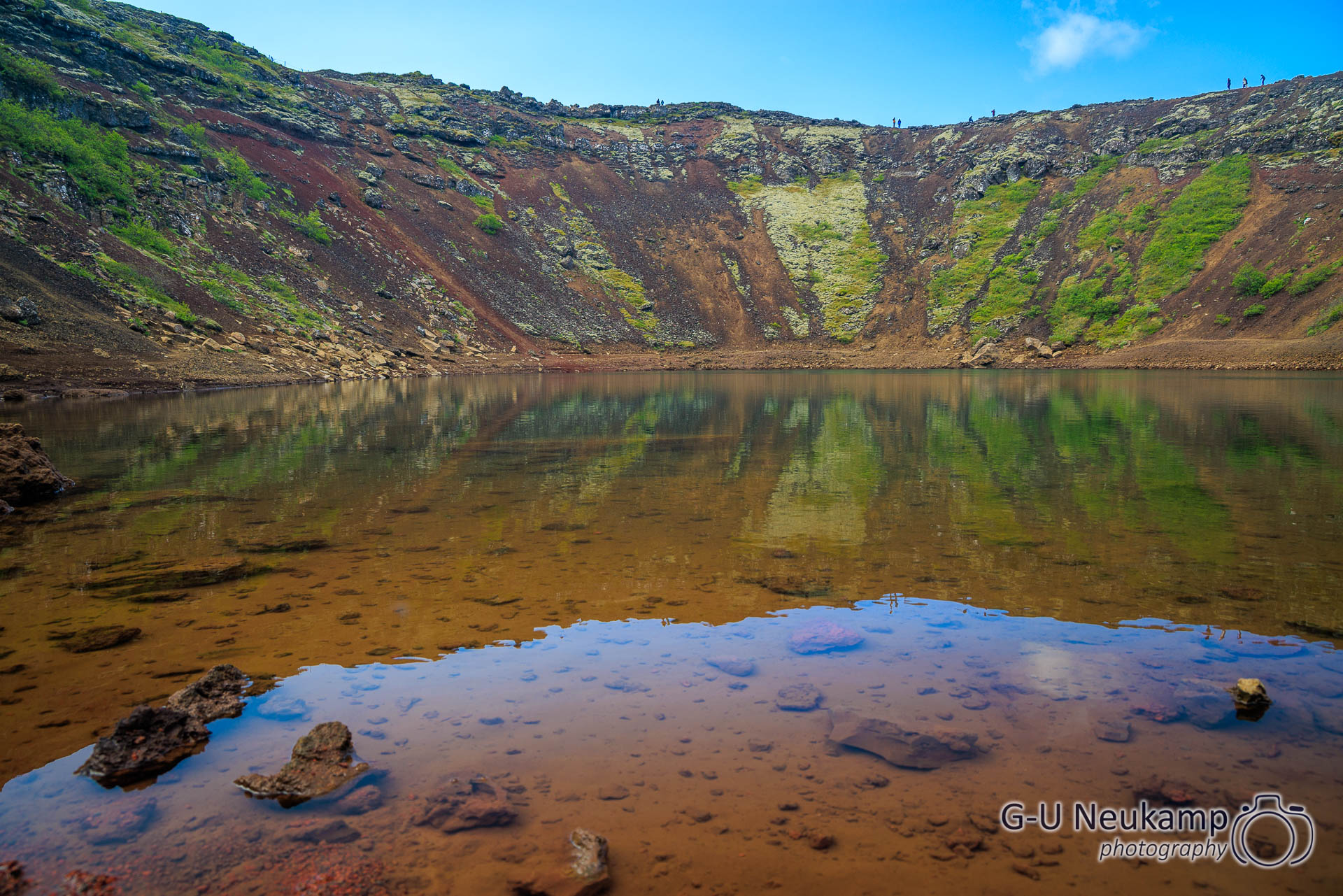
First on the agenda was Kerið crater, a crater filled with water. You had to pay an entrance fee at a small booth (but parking was free) and then you could walk around the crater and down to the lake. We had feared that we would have to walk up there, but that wasn’t the case. The crater was only about 20 meters behind the booth. It was a great sight, very impressive again. At times, you could almost believe you were on a hiking trail in Switzerland, if only the red earth and the Icelandic flag 🇮🇸 weren’t there.
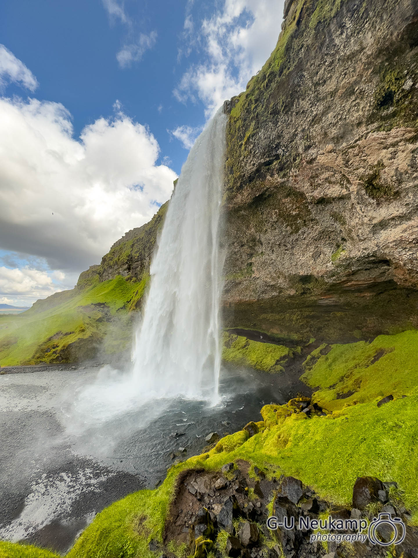
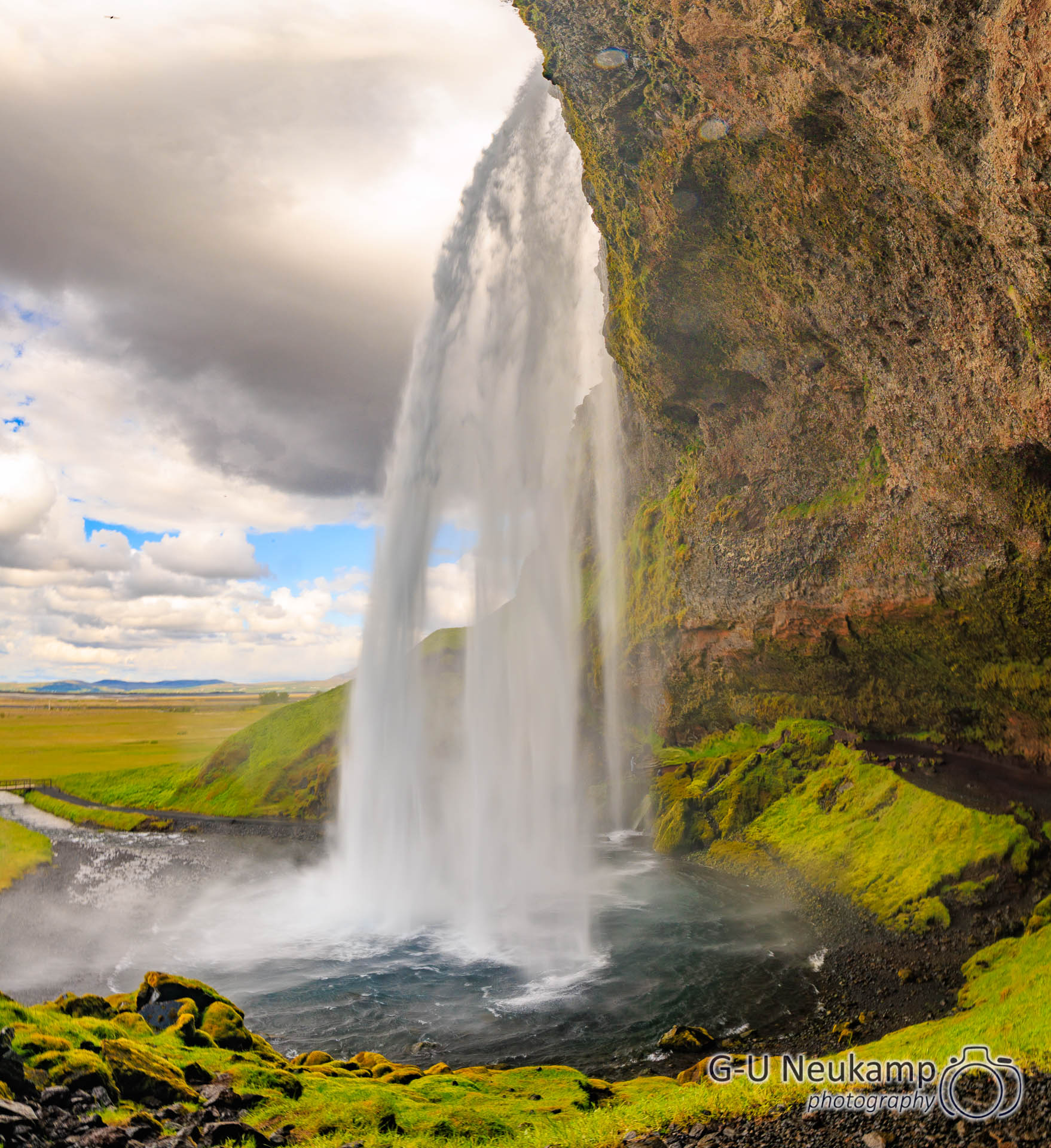
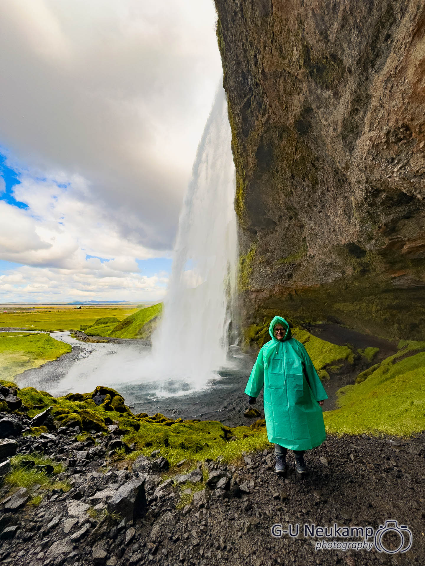
Afterwards, we made our way to the next waterfall, Seljalandsfoss.
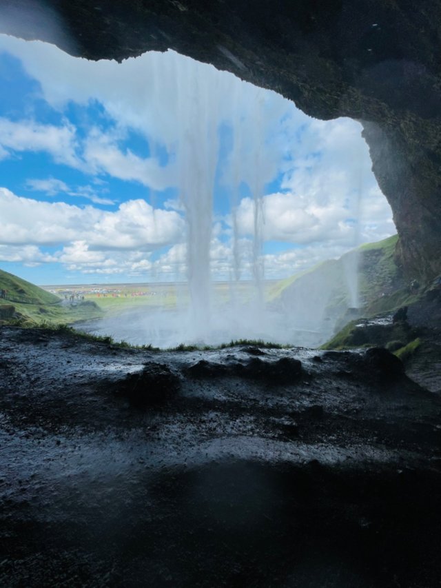
Seljalandsfoss is one of the most spectacular waterfalls in the country – not only because of its height of 65 meters, but above all because you can walk behind it. A narrow path leads into a small cave from which you can view the landscape through the curtain of falling water – a unique perspective that is rarely found elsewhere.
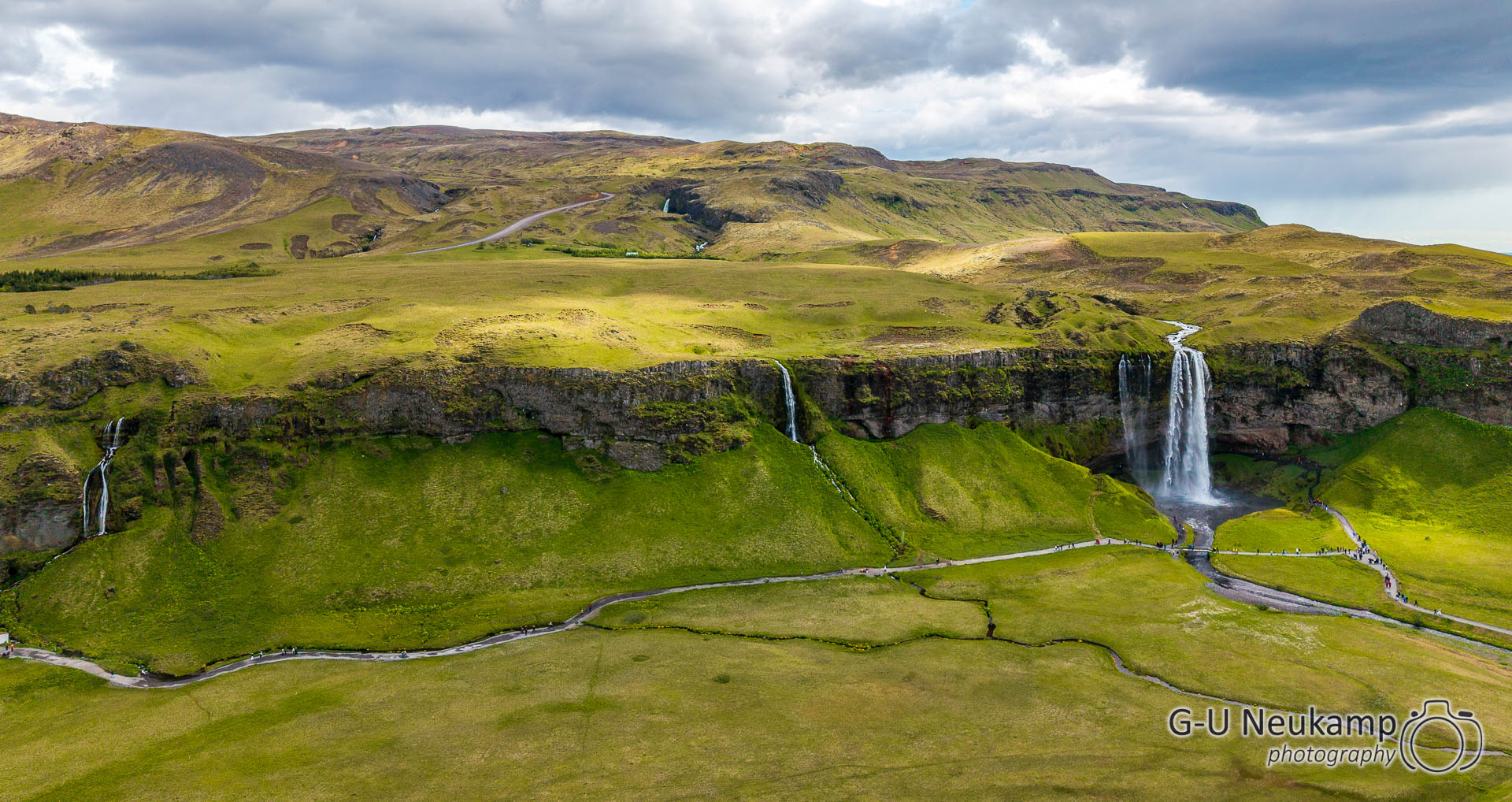
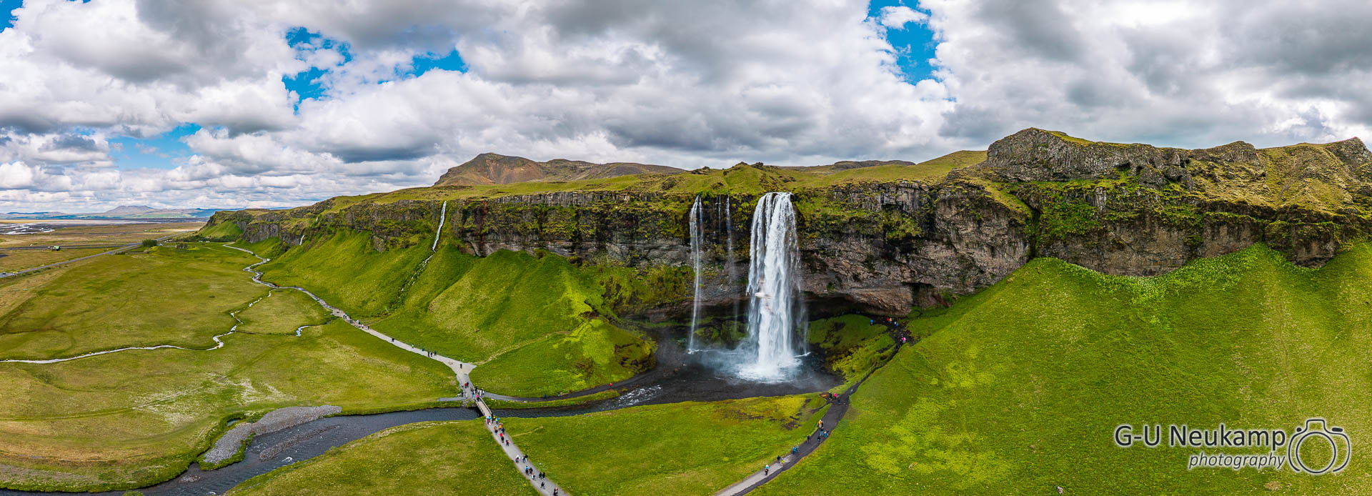
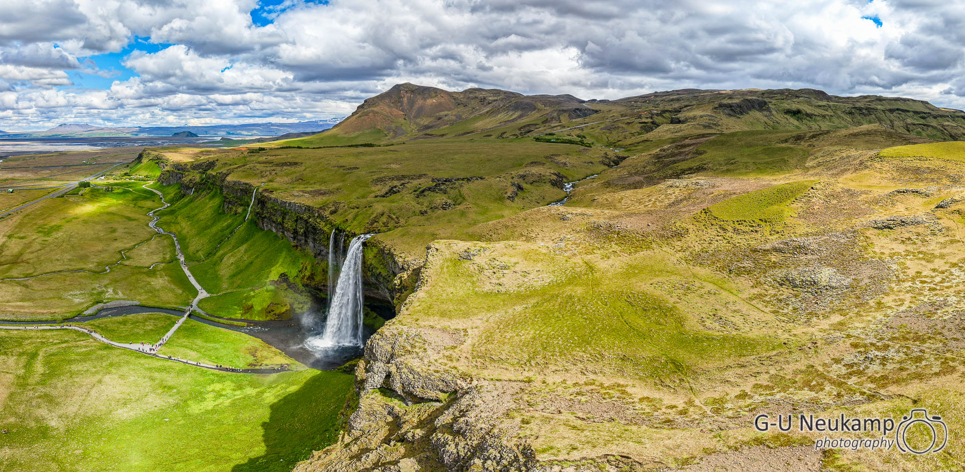
The waterfall is fed by the Seljalandsá glacial river and is located directly on the ring road, making it easily accessible.
Seljalandsfoss – a waterfall where you can actually stand behind and feel the power of nature – and get thoroughly wet. 😉
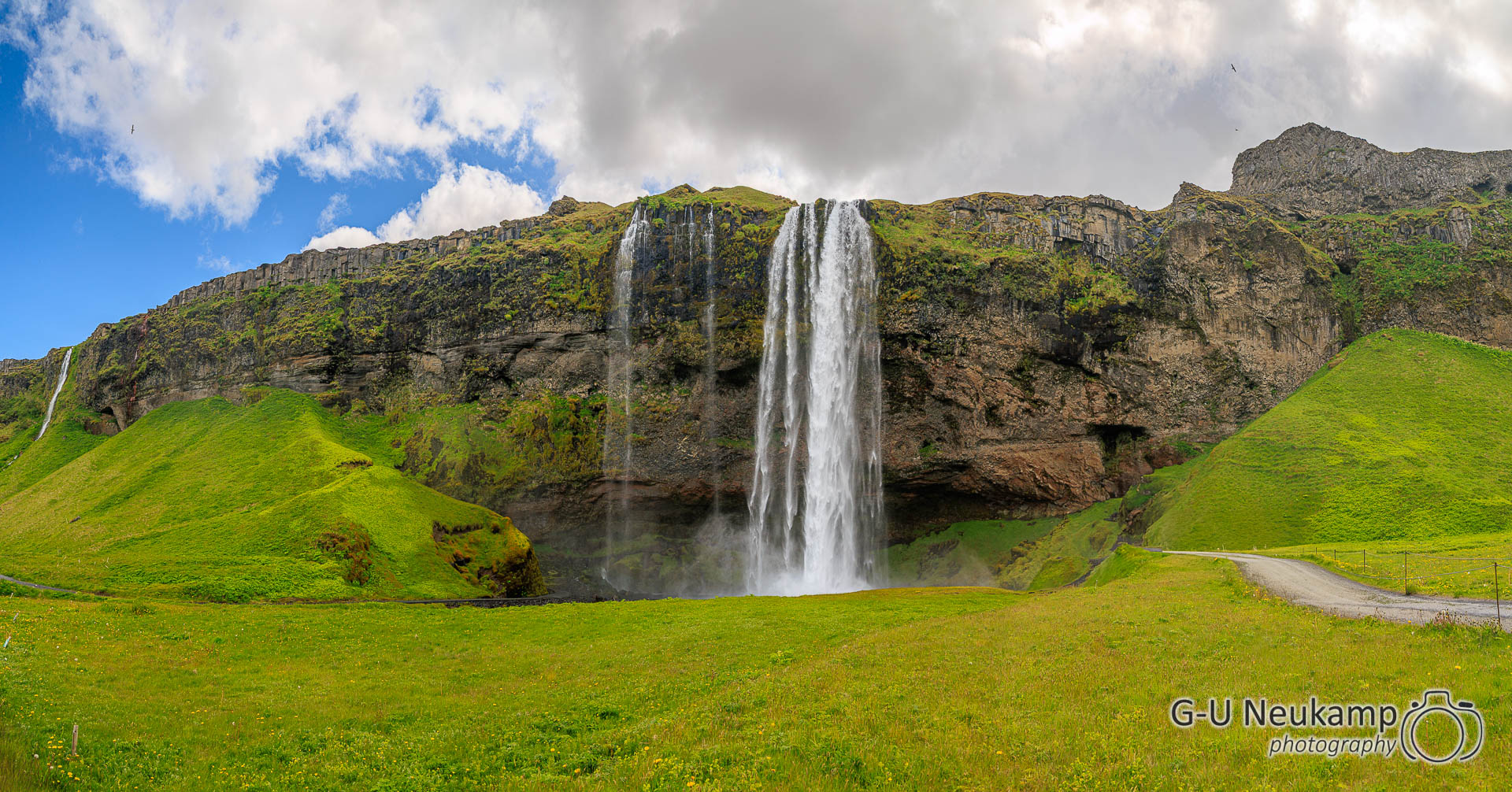
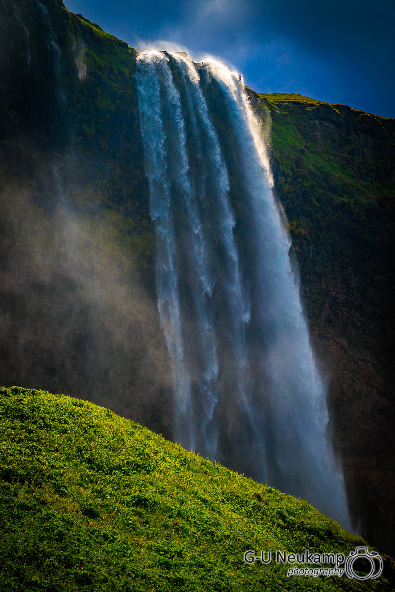
Then I launched the drone again from a distance. You can see a total of three waterfalls on the pictures.
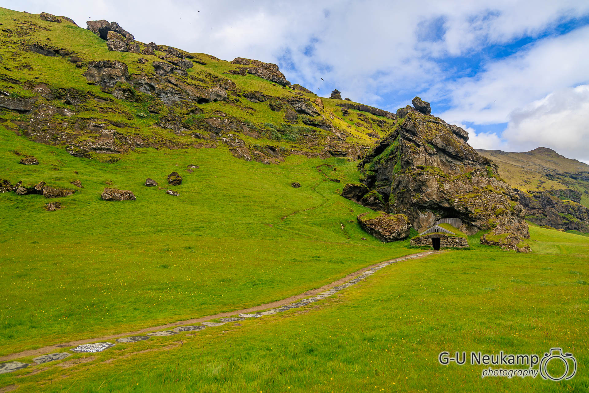
Our next destination was a well-known plane wreck on Solheimasandur beach. On the way there, we discovered a cave dwelling. Several other people had stopped there too, so we went there as well. It was the Rutshellir cave.
There are almost 200 man-made caves on 90 farms in southern Iceland. These are not known in other parts of the country. Some of these caves are listed as historical monuments. This cave, called Rutshellir, is located directly on the ring road and is therefore very well known. The main cave, which leads straight into the rock, measures about 20 meters and was probably used as a hayloft. A smaller cave of about 8 meters, connected at a right angle on the inside, was probably used as a smithy.
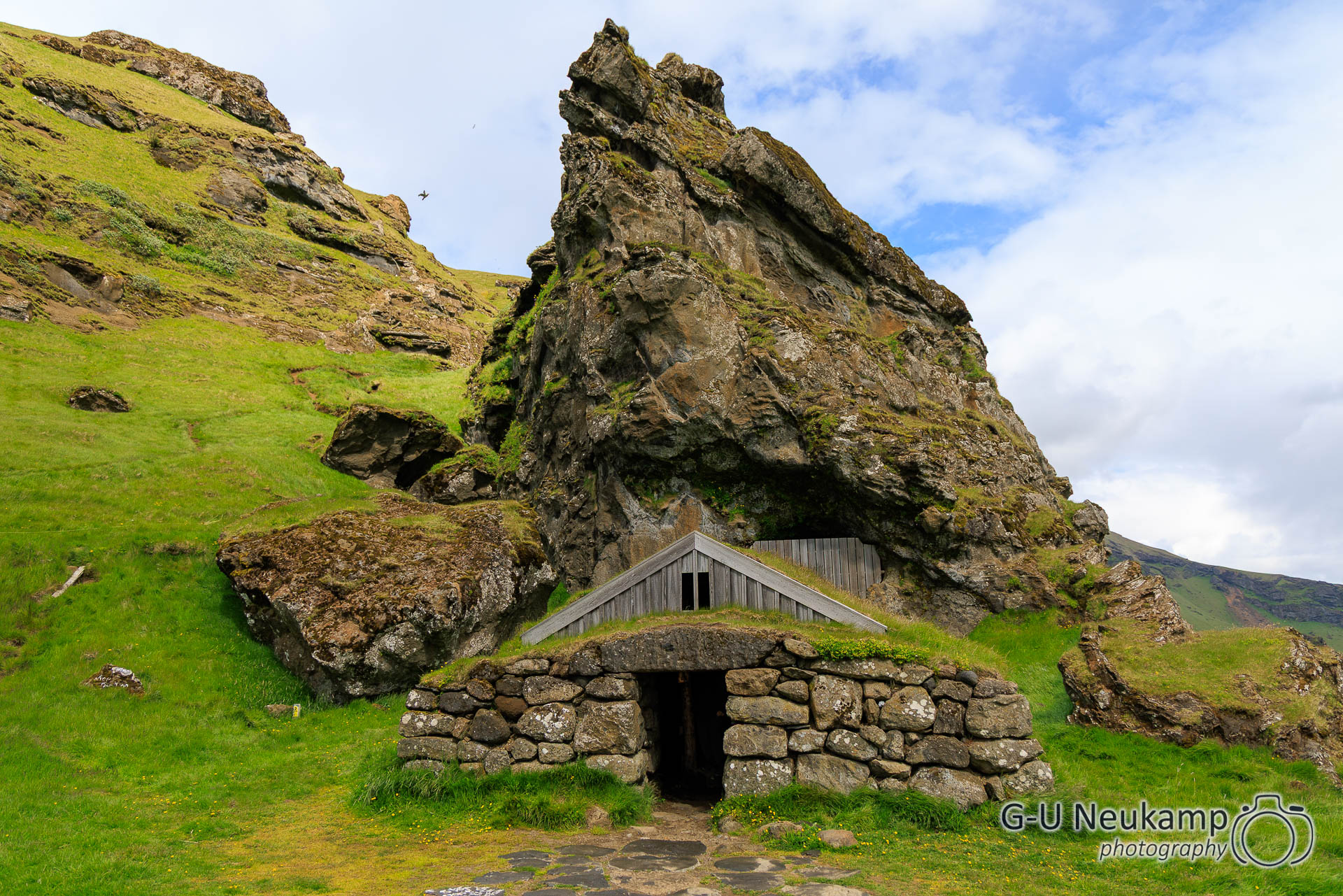
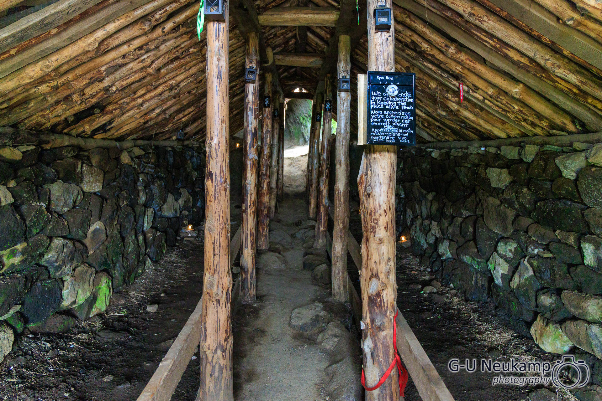
We went inside, but overall it was unspectacular, so we quickly continued on our journey.
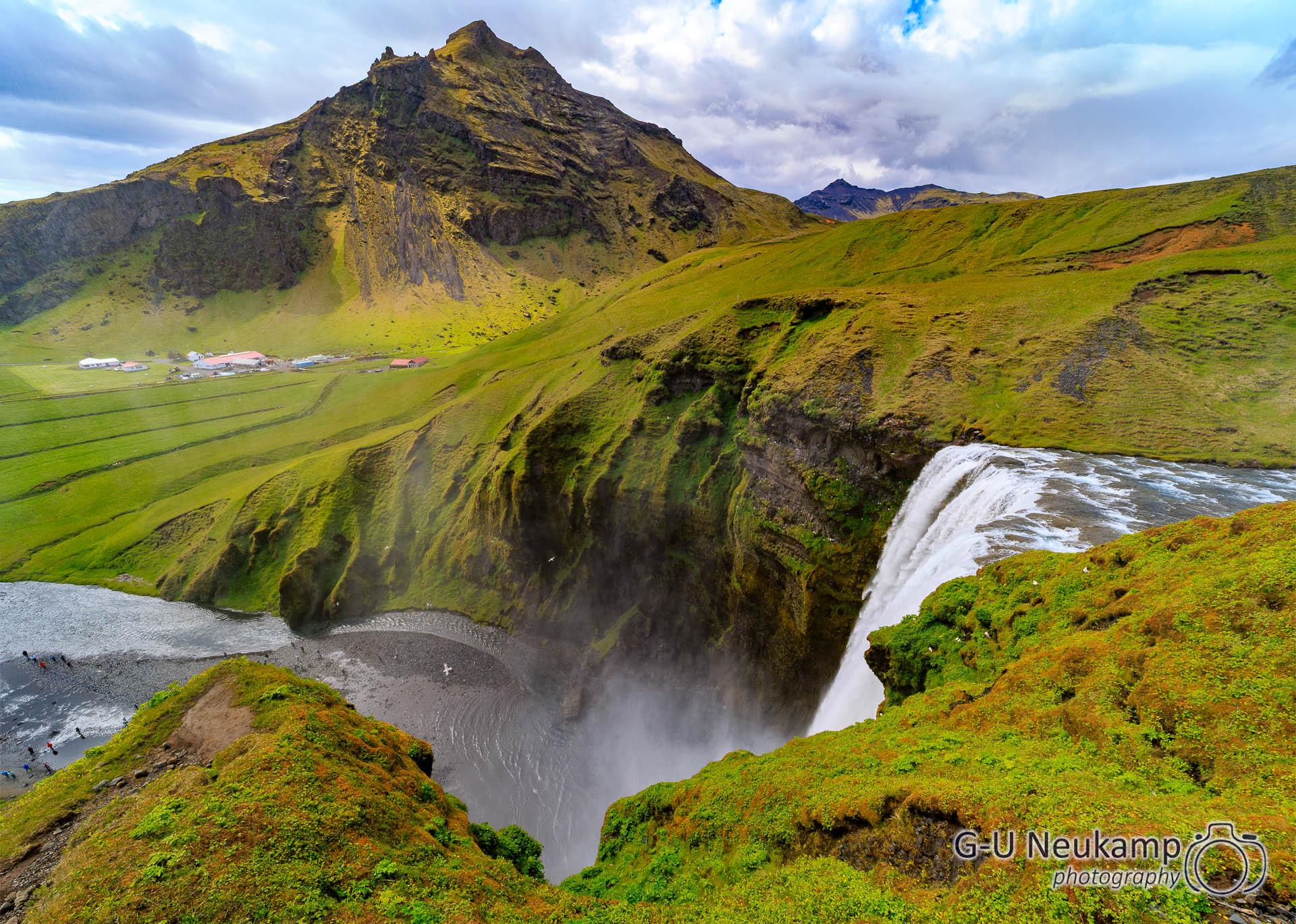
Then we drove past Skógafoss and visited it too. You could get very close to it by walking through the creek. In the spray, a double rainbow appeared in the beautiful sunshine:
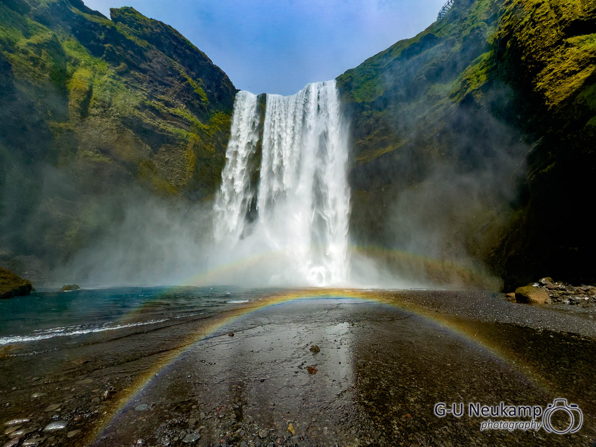
On the mountain next to it, you could climb 500 steps to a viewing platform and see the waterfall from above. However, we found that it wasn’t really worth the effort. The view from below is beautiful enough.
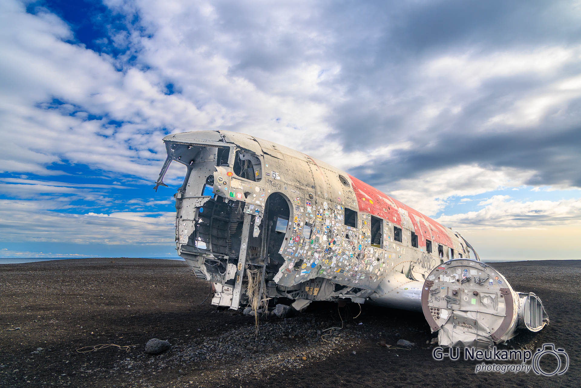
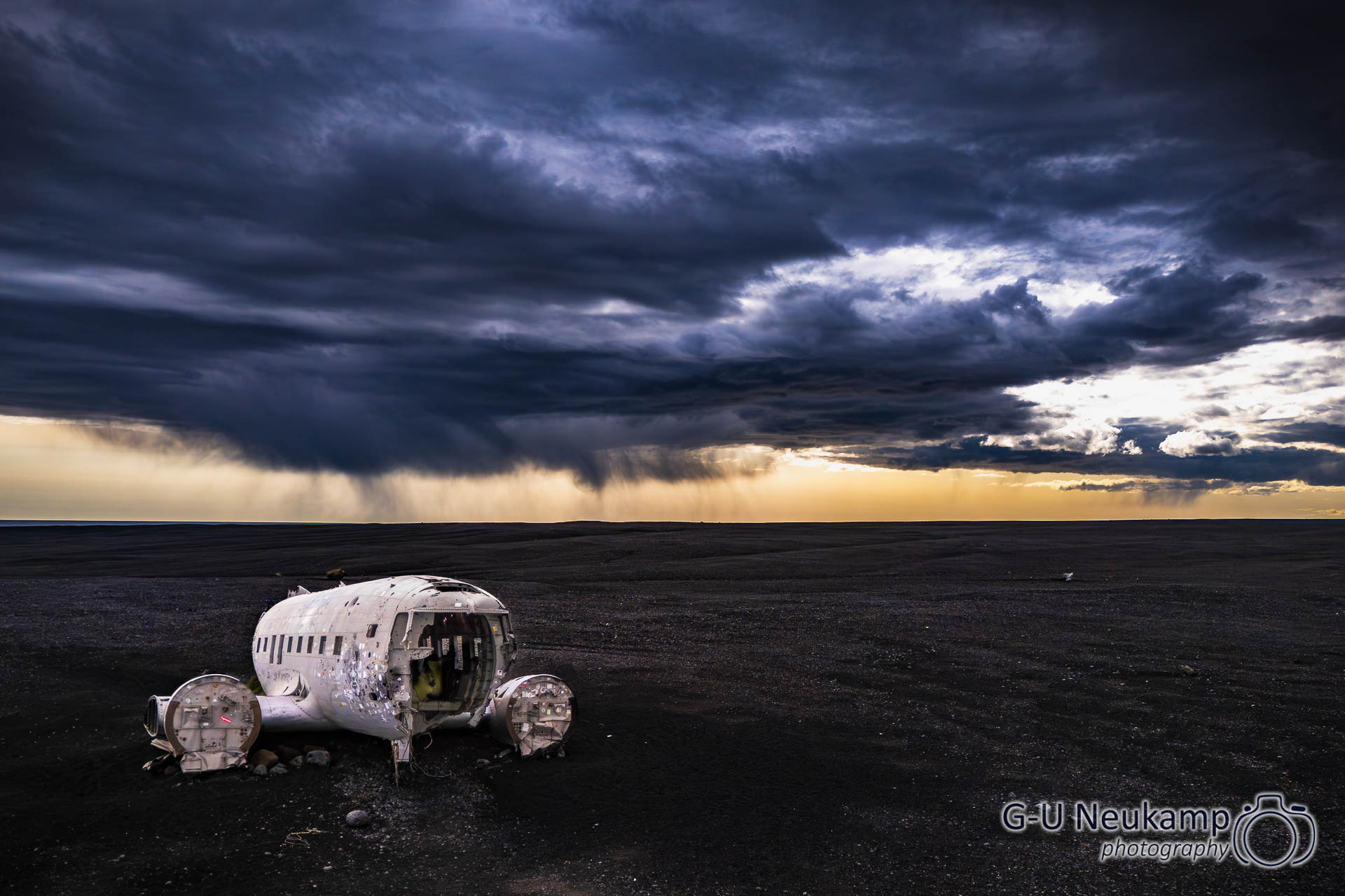
We then continued onward and finally reached our destination: the well-known wreckage of a DC3 aircraft. Well, almost, because you still have to walk a good 3.5 km from the parking lot to get there. There is a shuttle bus, but it costs €20 per person for a round trip, in addition to the €7 parking fee. We thought that was too expensive, so we walked there. However, it was well worth it.
Trivia: The stranded DC-3 in Iceland
On November 21, 1973, a US Navy Douglas DC-3 with seven crew members took off from Höfn bound for Keflavík – but it never arrived. Due to severe icing, the aircraft lost altitude and had to make an emergency landing on a frozen river near the coast. Although the ice broke under the weight, the aircraft did not sink. All crew members were able to disembark unharmed.The damaged aircraft was never recovered. Today, only the main fuselage remains; heavy rain, frost, and violent storms have caused the DC-3 to increasingly fall apart. Today, the wreckage is a popular “lost place.” One reason for this is certainly the rugged landscape that surrounds it.
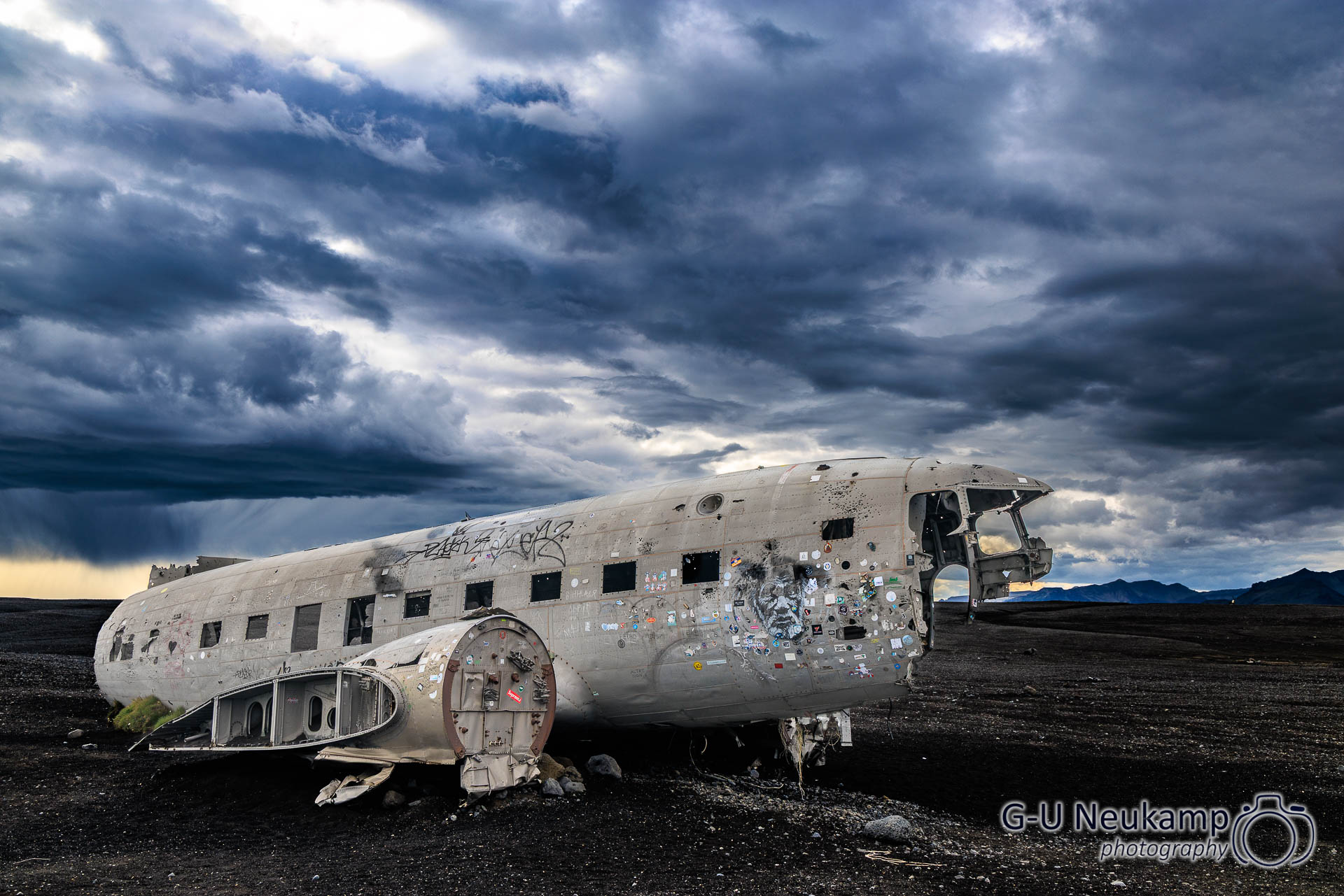
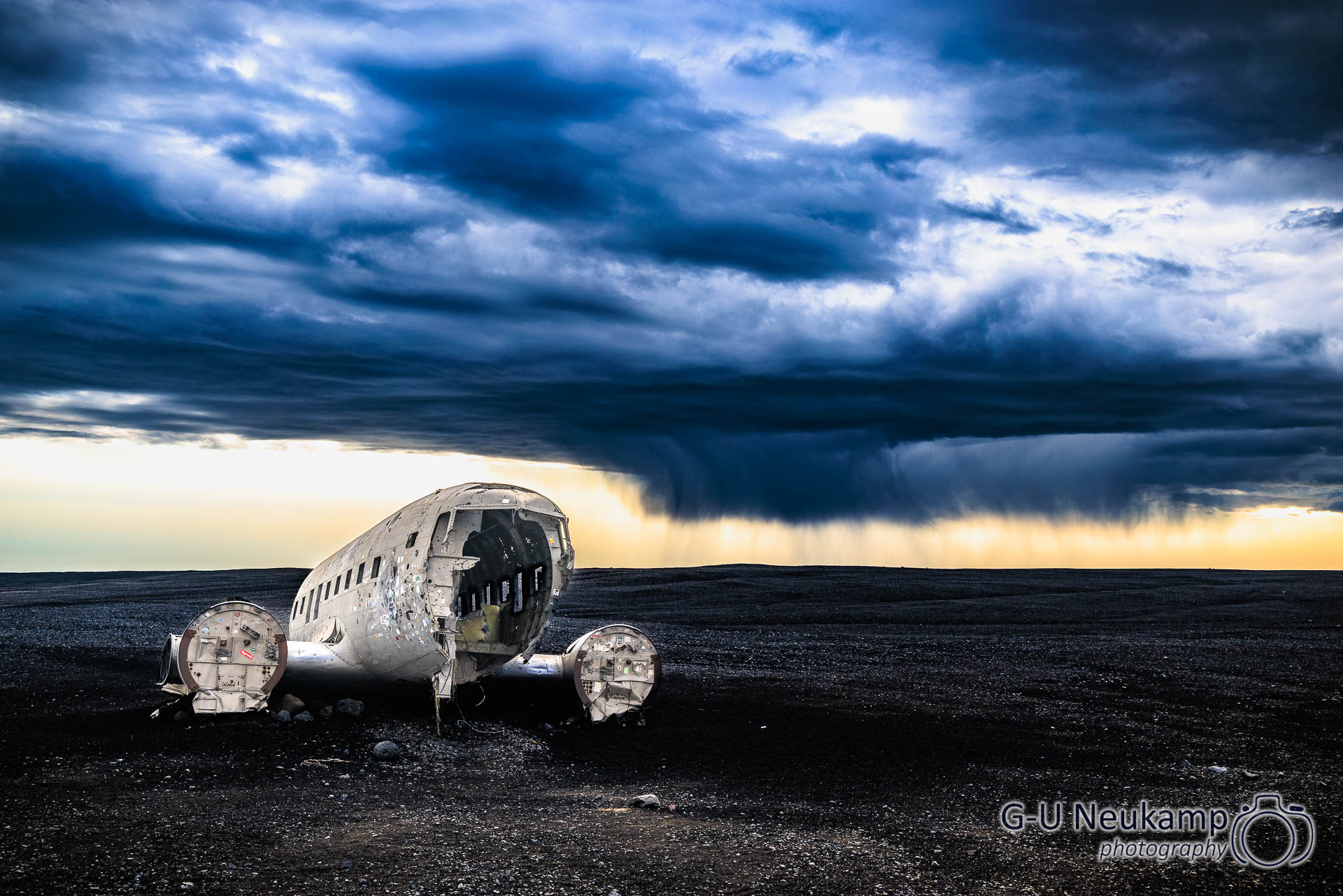
On the way to the wreck, the sky became increasingly overcast, creating a wonderful atmospheric lighting:
Then it was already time to look for a place to stay. We chose Vik, a nice little town about a 20-minute drive away. We actually wanted to go to Dyrhólaey, to see the rock arch and black beach, but unfortunately it was too late to make it there today. That meant we would have to drive back a little bit tomorrow, as Vik is located further east on the ring road. The campsite in Vik was almost too big for us. But we managed to find a good spot there again. Tired after the long hike to the plane wreck, we prepared dinner. It rained heavily during the night, but we slept very well in our camper.